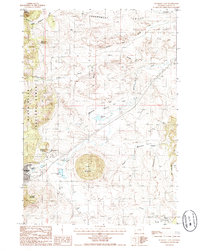
1984 Map of Sundance East
USGS Topo · Published 1985About this map
The town of Sundance anchors the southwestern corner of this landscape, positioned at the edge of the Black Hills National Forest. The 1980s terrain is defined by prominent peaks including Sundance Mountain and Green Mountain, which rise sharply above the drainage systems of Sundance Creek and Medicine Flat Creek. Water management is a visible priority across the northern half of the map, where a network of features like Diversion Ditch and various canals cross Government Valley.
Find a feature on this map
33 named features on this map. Tap any name to fly to it.
Don’t see what you’re looking for? This feature index may not catch every label — zoom into the map to look around manually.
Map Details
Editions of this 1984 Sundance East Map
This is the sole edition of this map. No revisions or reprints were ever made.
Other maps of this area

1898 · Sundance
USGS Topo · 1:125,000

1901 · Aladdin
USGS Topo · 1:125,000

1902 · Sundance
USGS Topo · 1:125,000

1903 · Aladdin
USGS Topo · 1:125,000

1954 · Gillette
USGS Topo · 1:250,000

1955 · Gillette
USGS Topo · 1:250,000

1958 · Gillette
USGS Topo · 1:250,000

1958 · Beulah
USGS Topo · 1:62,500

1958 · Tinton
USGS Topo · 1:62,500

1958 · Sundance
USGS Topo · 1:62,500