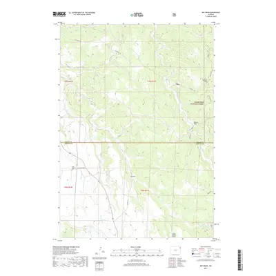
2017 Map of Dry Draw
USGS Topo · Published 2017About this map
Black Hills National Forest land dominates the northeastern corner of this terrain, where the high ridges are carved by Lost Canyon and Melquist Gulch. This high-altitude landscape is defined by the headwaters of several drainage systems, including the southward-flowing Soldier Cr and Inyan Kara Cr. The topography shifts significantly across the boundary between Crook and Weston counties, transitioning from the complex draws and ridges of the forest into the more open expanse of Canyon Springs Prairie to the south.
Find a feature on this map
21 named features on this map. Tap any name to fly to it.
Don’t see what you’re looking for? This feature index may not catch every label — zoom into the map to look around manually.
Map Details
Editions of this 2017 Dry Draw Map
This is the sole edition of this map. No revisions or reprints were ever made.
Other maps of this area

1898 · Sundance
USGS Topo · 1:125,000

1902 · Sundance
USGS Topo · 1:125,000

1954 · Gillette
USGS Topo · 1:250,000

1955 · Gillette
USGS Topo · 1:250,000

1958 · Gillette
USGS Topo · 1:250,000
1958 · Four Corners
USGS Topo · 1:62,500
1958 · Inyan Kara Mountain
USGS Topo · 1:62,500

1958 · Tinton
USGS Topo · 1:62,500

1958 · Sundance
USGS Topo · 1:62,500

1962 · Gillette
USGS Topo · 1:250,000