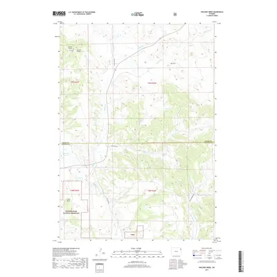
2017 Map of Sheldon Creek
USGS Topo · Published 2017About this map
Thunder Basin National Grassland dominates the southwestern portion of this landscape, marking a transition between the open range and the distinct geological features of the Wyoming plains. The map reveals a land defined by its drainages, where Inyan Kara Cr and Sheldon Cr carve paths through the terrain. The presence of Greenwood Cem near Wildcat Canyon provides a vital point of reference for genealogists and local historians tracing early inhabitants of this border region.
Find a feature on this map
24 named features on this map. Tap any name to fly to it.
Don’t see what you’re looking for? This feature index may not catch every label — zoom into the map to look around manually.
Map Details
Editions of this 2017 Sheldon Creek Map
This is the sole edition of this map. No revisions or reprints were ever made.
Other maps of this area

1898 · Sundance
USGS Topo · 1:125,000

1902 · Sundance
USGS Topo · 1:125,000

1918 · Moorcroft
USGS Topo · 1:125,000

1954 · Gillette
USGS Topo · 1:250,000

1955 · Gillette
USGS Topo · 1:250,000

1957 · Nefsy Divide
USGS Topo · 1:62,500

1957 · Upton
USGS Topo · 1:62,500

1958 · Gillette
USGS Topo · 1:250,000
1958 · Inyan Kara Mountain
USGS Topo · 1:62,500

1958 · Sundance
USGS Topo · 1:62,500