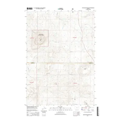
2015 Map of Inyan Kara Mountain
USGS Topo · Published 2015About this map
Black Hills National Forest land dominates this high-plains landscape, centered on the prominent peak of Inyan Kara Mtn. The terrain is defined by a series of significant elevations including Mt Tom and Strawberry Mtn, separated by deep drainage systems like Dry Draw and W Fork Skull Cr. This 2015 survey reveals a ranching and forestry-oriented landscape where water management is critical, evidenced by Paxton Reservoir and Clark Reservoir. The border between Crook and Weston Counties bisects the southern half of the sheet. Remote access is provided by a network of rural routes such as Schlup Rd and Green Mountain Rd, which navigate the varying elevations between Cedar Ridge and the southern Star Butte. The winding course of Inyan Kara Cr cuts through the northern sections, illustrating the typical high-desert hydrology of the region.
Find a feature on this map
30 named features on this map. Tap any name to fly to it.
Don’t see what you’re looking for? This feature index may not catch every label — zoom into the map to look around manually.
Map Details
Editions of this 2015 Inyan Kara Mountain Map
This is the sole edition of this map. No revisions or reprints were ever made.
Other maps of this area
1898 · Sundance
USGS Topo · 1:125,000
1902 · Sundance
USGS Topo · 1:125,000

1954 · Gillette
USGS Topo · 1:250,000

1955 · Gillette
USGS Topo · 1:250,000

1958 · Gillette
USGS Topo · 1:250,000
1958 · Four Corners
USGS Topo · 1:62,500
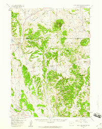
1958 · Inyan Kara Mountain
USGS Topo · 1:62,500
1958 · Tinton
USGS Topo · 1:62,500
1958 · Sundance
USGS Topo · 1:62,500

1962 · Gillette
USGS Topo · 1:250,000