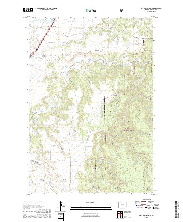
2021 Map of Red Canyon Creek
USGS Topo · Published 2021About this map
The Black Hills National Forest landscape in this area is defined by a series of prominent drainage divides and deep canyons cutting through northeastern Wyoming. Significant terrain features like Williams Divide and Riflepit Divide frame the drainage basins of S Redwater Cr and Sundance Cr. The northern reaches of the map include the flat expanse of Government Valley and the Rocky Ford Reservoir, which provided vital water resources in a region characterized by numerous intermittent gulches and draws. Historically significant routes such as Old US Hwy 14 and Moskee Rd traverse the high ground, connecting isolated springs like Cranberry Spring and Quail Spring. The intricate network of forest service roads, including Grand Canyon Rd, illustrates the ongoing management and access patterns within these timbered highlands during the early twenty-first century.
Find a feature on this map
44 named features on this map. Tap any name to fly to it.
Don’t see what you’re looking for? This feature index may not catch every label — zoom into the map to look around manually.
Map Details
Editions of this 2021 Red Canyon Creek Map
This is the sole edition of this map. No revisions or reprints were ever made.
Other maps of this area

1898 · Sundance
USGS Topo · 1:125,000

1901 · Aladdin
USGS Topo · 1:125,000

1902 · Sundance
USGS Topo · 1:125,000

1903 · Aladdin
USGS Topo · 1:125,000

1954 · Gillette
USGS Topo · 1:250,000

1955 · Gillette
USGS Topo · 1:250,000

1958 · Gillette
USGS Topo · 1:250,000

1958 · Beulah
USGS Topo · 1:62,500

1958 · Tinton
USGS Topo · 1:62,500

1958 · Sundance
USGS Topo · 1:62,500