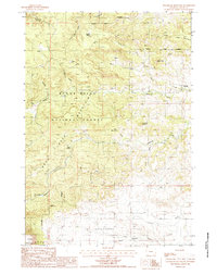
1984 Map of Sugarloaf Mountain
USGS Topo · Published 1985About this map
Black Hills and the Bear Lodge Mountains converge in this high-elevation corner of Wyoming, where the landscape is defined by the complex drainages of Redwater Creek. The terrain is characterized by prominent peaks and plateaus, including the namesake Sugarloaf Mountain, Table Mountain, and Skunk Peak. Water sources are critical features in this arid mountain environment, marked by sites such as Merrick Spring, Dean Spring, and the Hemler Res.
Find a feature on this map
27 named features on this map. Tap any name to fly to it.
Don’t see what you’re looking for? This feature index may not catch every label — zoom into the map to look around manually.
Map Details
Editions of this 1984 Sugarloaf Mountain Map
This is the sole edition of this map. No revisions or reprints were ever made.
Other maps of this area

1898 · Sundance
USGS Topo · 1:125,000

1901 · Aladdin
USGS Topo · 1:125,000

1902 · Sundance
USGS Topo · 1:125,000

1903 · Aladdin
USGS Topo · 1:125,000

1954 · Gillette
USGS Topo · 1:250,000

1955 · Gillette
USGS Topo · 1:250,000

1958 · Gillette
USGS Topo · 1:250,000

1958 · Beulah
USGS Topo · 1:62,500

1958 · Tinton
USGS Topo · 1:62,500

1958 · Sundance
USGS Topo · 1:62,500