1900s (20th Century) Maps of Laramie County, Wyoming
Explore 128 historic maps of Laramie County from the 1900s (20th Century). These maps offer a rare glimpse into what life looked like during the 1900s — showing old roads, neighborhoods, homes, and landmarks that have changed or disappeared over time.
Whether you're researching your family's past, planning a metal detecting trip, or studying how Laramie County's landscape evolved across the 1900s, these high-resolution maps are a powerful tool for exploring the history of this region.
- Focus on a specific era: All maps on this page are from the 1900s, giving you a focused view of this time period.
- See what’s changed: Compare century-old streets, trails, and buildings to today's modern landscape using overlays and satellite layers.
- Research with precision: Use these maps for genealogy, historical research, land use analysis, or educational projects.
- View, download, or print: Maps are fully viewable online in high resolution, and can be downloaded or printed for your own records.
Start exploring Laramie County's history through authentic maps from the 1900s. This is your window into the past.
Laramie County, WY maps
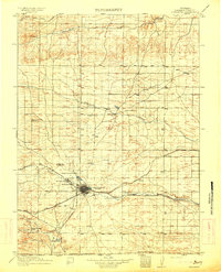
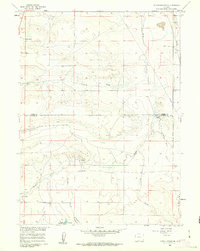
(128)- 1905 Map of Sherman
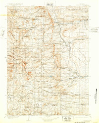 1905 Sherman1905 Print · USGSThe Laramie foothills and high plains at the turn of the century show a landscape defined by ranching and the railroad. Researchers can trace the Union Pacific RR through old stops like Leslie or locate historic homesteads such as Bakers Ranch and Islay PO.4 unique versions available
 - 1907 Map of Livermore, 1954 Print
 1907 Livermore1954 Print · USGSLarimer County at the turn of the century shows a frontier landscape transitioning into a settled ranching and rail corridor. Genealogists and historians can trace family-named sites like Maxwell Ranch alongside early landmarks like the Forks Hotel and Campbell Grove School.2 unique versions available
 - 1908 Map of Eaton, 1957 Print
 1908 Eaton1957 Print · USGSWeld and Larimer counties are seen here in the early twentieth century as irrigation and rail lines transformed the high plains. Researchers can trace the development of agricultural hubs like Pierce and Severance alongside rural landmarks like Albert School and the Indian Springs Coal Mine.
 - 1909 Map of Livermore
 1909 Livermore1909 Print · USGSNorthern Colorado at the turn of the century shows a landscape of developing irrigation and early mountain industry. Trace the early streets of Fort Collins or find the remote Forks Hotel and Empire Mine among the foothills.4 unique versions available
 - 1910 Map of Eaton
 1910 Eaton1910 Print · USGSNorthern Colorado at the turn of the century shows a landscape transformed by railroads and early irrigation projects. Genealogists can locate many family-named landmarks like Slaxton Ranch and rural schoolhouses including Abbot School and Birch School.3 unique versions available
 - 1911 Map of Cheyenne, 1961 Print
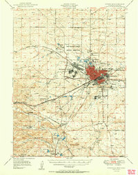
 1911 Cheyenne1961 Print · USGSCheyenne was a bustling rail and military center in the years before the Great War. Genealogists and historians can trace the footprint of Fort D.A. Russell and find early rural sites like Campstool and Paola.
 - 1914 Map of Cheyenne
 1914 Cheyenne1914 Print · USGSCheyenne stands at the crossroads of three major railroads in the years before the Great War. Researchers can trace the layout of the Fort D.A. Russell Military Reservation and find local landmarks like Ridley School and Campstool.3 unique versions available
 - 1948 Map of Sherman Mountains, 1958 Print
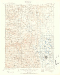
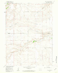
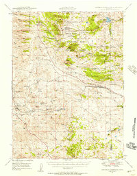 1948 Sherman Mountains1958 Print · USGSThe high Wyoming plateau between Laramie and Cheyenne is captured here after the war, showing the legendary Lincoln Highway corridor and Medicine Bow ranching life. Researchers can trace the path of the Union Pacific through Sherman and Buford or locate historic family outposts like the K P Ranch.2 unique versions available
 - 1948 Map of Ragged Top Mountain, 1965 Print
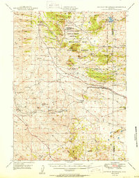
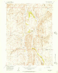
 1948 Ragged Top Mountain1965 Print · USGSAlbany County ranching and mining operations are captured here just after the war, showing a high-country network of family-owned land and federal reserves. Researchers can trace historic homesteads like Coles Ranch or locate industrial sites such as the Feldspar Strip Mine and University Quarry.2 unique versions available
 - 1950 Map of Ragged Top Mountain
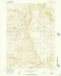
 1950 Ragged Top Mountain1950 Print · USGSHigh plains ranching and military maneuvers converge in Albany County during the mid-century, where the Medicine Bow National Forest meets the open range. Genealogists and historians can trace legacy holdings like the King Brothers Ranch or the industrial footprint of the Feldspar Strip Mine.
 - 1950 Map of Sherman Mountains
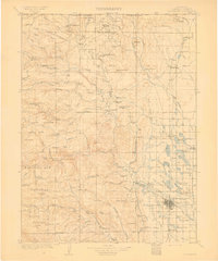
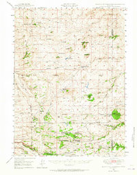
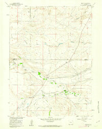
 1950 Sherman Mountains1950 Print · USGSHigh Wyoming ranching and military lands are captured here at mid-century as the Lincoln Highway and Union Pacific cross the Laramie Mountains. Genealogists can locate named homesteads like the Davis Ranch and the landmark Ames Monument.2 unique versions available
 - 1950 Map of Cheyenne
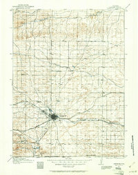
 1950 Cheyenne1950 Print · USGSCheyenne and its surrounding high plains are captured here during a period of post-war expansion and military prominence. Researchers can trace the layout of the Fort Francis E Warren Military Reservation or locate family ranch sites like Rees Brothers Ranch and Diamond Camp.
 - 1954 Map of Cheyenne, 1963 Print
 1954 Cheyenne1963 Print · USGSSoutheastern Wyoming's high plains and the capital city's mid-century expansion are documented here during the early Cold War. Genealogists and historians can trace rail-aligned settlements like Pine Bluffs and Hillsdale, or explore landmarks like the Ames Monument and Francis E. Warren Air Force Base.3 unique versions available
 - 1954 Map of Greeley, 1966 Print
 1954 Greeley1966 Print · USGSNorthern Colorado transitions from high-alpine peaks to the irrigated South Platte valley during this mid-century period of growth. Genealogists and historians can trace rail-connected hubs like Greeley and Longmont alongside landmarks like Horsetooth Reservoir and Estes Park.3 unique versions available
 - 1955 Map of Indian Guide, 1956 Print
 1955 Indian Guide1956 Print · USGSAlbany County ranching country and the high canyons of the Laramie Range come into focus in the mid-1950s. Genealogists and historians can trace the Old Wheatland Road and locate the sites of the South Sybille Sch and Shaffer Sch.3 unique versions available
 - 1955 Map of Goat Mountain, 1957 Print
 1955 Goat Mountain1957 Print · USGSHigh-plains ranching and mineral prospecting define this corner of Wyoming during the mid-fifties. Researchers can locate remote outposts like Iron Mountain Camp and family sites including the Bosler Ranch and Maloin Ranch.3 unique versions available
 - 1957 Map of Greeley
 1957 Greeley1957 Print · USGSNorthern Colorado in the mid-fifties is captured here as the agricultural plains of Weld County meet the high peaks of the Front Range. Genealogists and historians can trace rail-linked towns like Keenesburg and Roggen or locate early water features such as Boyd Lake and Fossil Creek Reservoir.
 - 1958 Map of Cheyenne
 1958 Cheyenne1958 Print · USGSSoutheast Wyoming and the Nebraska border appear in the late 1950s as a hub of military defense and rail commerce. Genealogists can trace the Union Pacific through Cheyenne or locate the Horse Creek Oil Field and the State Capitol.2 unique versions available
 - 1958 Map of Greeley
 1958 Greeley1958 Print · USGSNorthern Colorado and the high peaks of the Front Range appear here in the mid-fifties as the region's agricultural and rail networks were fully established. Genealogists can locate family homes near Virginia Dale, Waverly, or Kuner, and trace the path of the Union Pacific Railroad through Greeley.
 - 1960 Map of Tremain
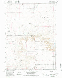 1960 Tremain1960 Print · USGSThe high plains of the Wyoming-Nebraska border come into focus in 1960, showing a landscape defined by cattle ranching and rail infrastructure. Researchers can trace historic family-named homesteads like Bull Canyon Ranch and Spahr Ranch alongside the Epworth Cem.3 unique versions available
 - 1960 Map of Petsch Reservoir, 1962 Print
 1960 Petsch Reservoir1962 Print · USGSLaramie and Goshen counties were defined by isolated ranching outposts and vital irrigation works in the early sixties. Genealogists can locate family landmarks like Gregory Ranch and Johnson Ranch or trace the route of the Union Pacific rail line.2 unique versions available
 - 1960 Map of Rocky Hollow, 1962 Print
 1960 Rocky Hollow1962 Print · USGSThe high plains along the border of Goshen and Laramie Counties are captured here in the early sixties. Researchers can trace the winding paths of Horse Creek and Cattail Creek or locate local landmarks like Rocky Hollow.
 - 1960 Map of Meriden, 1962 Print
 1960 Meriden1962 Print · USGSHigh plains ranching in Laramie and Goshen counties comes alive in the early sixties, showing the vital irrigation networks of the day. Trace family holdings like Petsch Ranch and Hunter Ranch alongside the Meriden Post Office.2 unique versions available
 - 1961 Map of Greeley
 1961 Greeley1961 Print · USGSNorthern Colorado's transition from high mountain peaks to irrigated plains is captured here just as the post-war population boom reached the Front Range. Researchers can trace early water infrastructure and rail lines like the Great Western RR connecting sugar beet hubs from Fort Collins to Greeley.
 - 1961 Map of Round Top Lake, 1963 Print
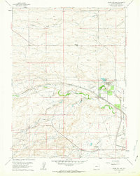 1961 Round Top Lake1963 Print · USGSThe high plains near Cheyenne in the early sixties reveal a landscape of military expansion and cattle ranching. Researchers can trace family-named holdings like Meadowlark Ranch and the industrial water systems serving Round Top Lake and the Girl Scout Camp.4 unique versions available
Showing maps 1-25 of 128
Top cities of Laramie County
- Cheyenne historical maps
- Ranchettes historical maps
- South Greeley historical maps
- Fox Farm–College historical maps
- Warren Air Force Base historical maps
- Burns historical maps
See more
Frequently asked questions
- What are the different types of historical maps available for Laramie County?
- What is the oldest map of Laramie County?
- Where can I purchase historical maps of Laramie County for my home or office?
- Where can I download high-res historical maps of Laramie County?
- Are there historical topographic maps available for Laramie County?
- Is there historical aerial imagery available for Laramie County?
- Where are historical maps of Laramie County sourced from?