1970s Maps of Lincoln County, Wyoming
Explore 5 historic maps of Lincoln County from the 1970s. These maps offer a rare glimpse into what life looked like during the 1970s — showing old roads, neighborhoods, homes, and landmarks that have changed or disappeared over time.
Whether you're researching your family's past, planning a metal detecting trip, or studying how Lincoln County's landscape evolved across the 1970s, these high-resolution maps are a powerful tool for exploring the history of this region.
- Focus on a specific era: All maps on this page are from the 1970s, giving you a focused view of this time period.
- See what’s changed: Compare century-old streets, trails, and buildings to today's modern landscape using overlays and satellite layers.
- Research with precision: Use these maps for genealogy, historical research, land use analysis, or educational projects.
- View, download, or print: Maps are fully viewable online in high resolution, and can be downloaded or printed for your own records.
Start exploring Lincoln County's history through authentic maps from the 1970s. This is your window into the past.
Lincoln County, WY maps
(5)- 1970 Map of Border, 1973 Print
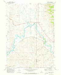 1970 Border1973 Print · USGSThe Idaho-Wyoming border comes alive in the early seventies, capturing a high-desert landscape defined by the Bear River and the Union Pacific Railroad. Genealogists and historians can trace old homestead sites near Chausse or explore the transit history of Border and Border Junction.2 unique versions available
 - 1970 Map of Boundary Ridge, 1973 Print
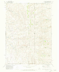 1970 Boundary Ridge1973 Print · USGSBoundary Ridge stood at the remote intersection of three states in the early seventies, a landscape of high plateaus and vital mountain springs. Researchers can trace historic grazing routes through Taylor Meadow and locate landmarks like the Windmill or the heights of Red Mtn.
 - 1970 Map of Geneva, 1973 Print
 1970 Geneva1973 Print · USGSHigh-altitude ranching and mountain geography define this borderlands area in 1970 as it straddles Bear Lake County and Wyoming. Genealogists can locate family-named sites like G H Hall Ranch, Mumford Ranch, and the Geneva Cem.
 - 1970 Map of Giraffe Creek, 1973 Print
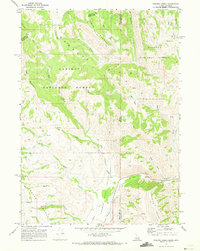 1970 Giraffe Creek1973 Print · USGSThe high-altitude border of Idaho and Wyoming is documented here in the 1970s as it was managed for water and forest resources. Researchers can trace the drainage of the Thomas Fork Valley and find irrigation landmarks like the Taylor Ditch and Thomas Fork Canal.
 - 1979 Map of Kemmerer, 1980 Print
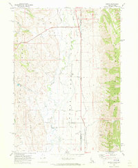
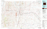 1979 Kemmerer1980 Print · USGSLincoln County in the late seventies reveals an economy built on coal and rail between the ridges of the Overthrust Belt. Trace the industrial landscape from the Elkol Strip Mine to the historic Union Pacific line and Fossil Butte National Monument.2 unique versions available
End of results
Showing maps 1-5 of 5
Top cities of Lincoln County
- Kemmerer historical maps
- Afton historical maps
- Star Valley Ranch historical maps
- Alpine historical maps
- Diamondville historical maps
- Cokeville historical maps
See more
Frequently asked questions
- What are the different types of historical maps available for Lincoln County?
- What is the oldest map of Lincoln County?
- Where can I purchase historical maps of Lincoln County for my home or office?
- Where can I download high-res historical maps of Lincoln County?
- Are there historical topographic maps available for Lincoln County?
- Is there historical aerial imagery available for Lincoln County?
- Where are historical maps of Lincoln County sourced from?