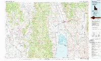
1980s Maps of Lincoln County, Wyoming
Explore 39 historic maps of Lincoln County from the 1980s. These maps offer a rare glimpse into what life looked like during the 1980s — showing old roads, neighborhoods, homes, and landmarks that have changed or disappeared over time.
Whether you're researching your family's past, planning a metal detecting trip, or studying how Lincoln County's landscape evolved across the 1980s, these high-resolution maps are a powerful tool for exploring the history of this region.
- Focus on a specific era: All maps on this page are from the 1980s, giving you a focused view of this time period.
- See what’s changed: Compare century-old streets, trails, and buildings to today's modern landscape using overlays and satellite layers.
- Research with precision: Use these maps for genealogy, historical research, land use analysis, or educational projects.
- View, download, or print: Maps are fully viewable online in high resolution, and can be downloaded or printed for your own records.
Start exploring Lincoln County's history through authentic maps from the 1980s. This is your window into the past.
Lincoln County, WY maps
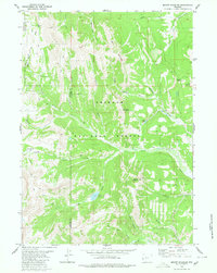
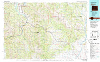
(39)- 1980 Map of Blind Bull Creek
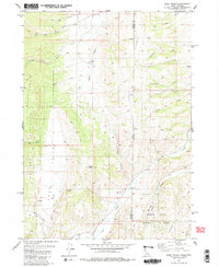
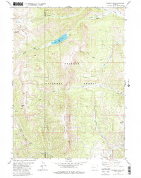
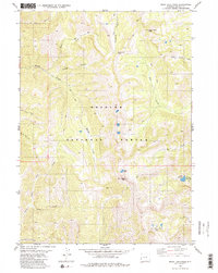
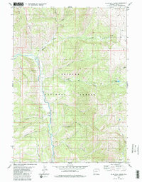 1980 Blind Bull Creek1980 Print · USGSThe western Wyoming high country is documented here during the late 1970s, showcasing the intersection of two national forests and the mining industry. Trace early mountain infrastructure like the Blind Bull Mine, the Box Y Ranch, and the isolated Blind Bull Lake.2 unique versions available
 - 1980 Map of Grover
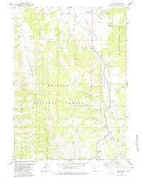
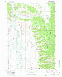 1980 Grover1980 Print · USGSThe Star Valley settlement corridor is captured here in the 1980s, showcasing the intersection of pioneer history and modern ranching life. Genealogists can locate the Grover Cem and trace the historic path of the Lander Cutoff (Emigrant Trail) past Auburn and Turnerville.
 - 1980 Map of Triple Peak
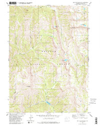
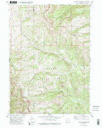
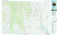
 1980 Triple Peak1980 Print · USGSThe Wyoming Range and Bridger National Forest are shown here in the late 1970s, at the intersection of Sublette and Lincoln Counties. Trace old high-altitude resource extraction and routes via Cottonwood Mine, Soda Lake, and the remote Mc Dougal Gap.3 unique versions available
 - 1980 Map of Man Peak
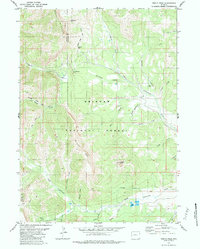
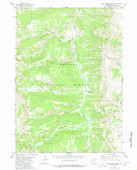
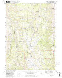
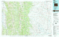
 1980 Man Peak1980 Print · USGSBridger National Forest land along the Greys River is documented here in the late twentieth century. Back-country researchers can trace the old Pack Trails used by rangers and outfitters to reach Man Peak, Virginia Peak, and Moose Flat Campground.2 unique versions available
 - 1980 Map of Mount Schidler
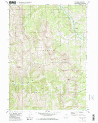
 1980 Mount Schidler1980 Print · USGSThe high Wyoming Range of the late seventies is captured here at the Sublette and Lincoln county line. Map collectors and hikers can trace remote pack trails through Red Castles, Bare Pass, and the high meadows of Menace Falls.2 unique versions available
 - 1980 Map of Thayne West
 1980 Thayne West1980 Print · USGSThe Star Valley region on the Idaho-Wyoming border thrived as a high-altitude agricultural hub in the early 1980s. Researchers can trace historical irrigation networks like Baker Ditch and locate local landmarks such as Haderlie Knoll and the Cem in Freedom.3 unique versions available
 - 1980 Map of Smoot
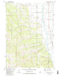
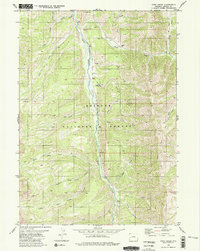
 1980 Smoot1980 Print · USGSStar Valley and the Gannett Hills are documented in the late twentieth century, showing the intersection of historic western migration and modern forest management. Trace the Emigrant Trail (Lander Cutoff) past Smoot and follow the Salt River south toward Salt River Pass.
 - 1980 Map of Elk Valley
 1980 Elk Valley1980 Print · USGSThe high ridges of the Gannett Hills straddle the Idaho and Wyoming border during the early eighties, marking a remote wilderness between two national forests. Researchers can trace historic backcountry routes like the Pack Trail past landmarks such as The Pinnacle and Clover Knoll.2 unique versions available
 - 1980 Map of Sage Valley
 1980 Sage Valley1980 Print · USGSSage Valley straddles the Idaho and Wyoming border in the late seventies, showing a high-country landscape of national forests and remote drainages. Researchers can trace historic access routes like the Tygee Trail and locate family-named landmarks such as Hardmans Hollow or Richardson Creek.2 unique versions available
 - 1980 Map of Box Canyon Creek
 1980 Box Canyon Creek1980 Print · USGSThe Lincoln County backcountry in the early eighties is mapped here through its river systems and forest trails. Trace the Greys River through the Bridger National Forest to find the Corral Creek Guard Station and Box Canyon Creek.3 unique versions available
 - 1980 Map of Red Top Mountain
 1980 Red Top Mountain1980 Print · USGSThe high Wyoming backcountry of Lincoln County is shown here in the 1980s as a wilderness of peaks and alpine lakes. Trace the primitive routes of the Pack Trail and Jeep Trail past Mount Fitzpatrick and Corral Creek Lake.2 unique versions available
 - 1980 Map of Park Creek
 1980 Park Creek1980 Print · USGSThe Greys River corridor in Lincoln County remains a vast wilderness of the Bridger National Forest during the late twentieth century. Researchers can trace historic access routes via Pack Trail and Jeep Trail systems connecting Three Forks Creek and Park Creek.2 unique versions available
 - 1980 Map of Wyoming Peak
 1980 Wyoming Peak1980 Print · USGSThe high ridges of the Wyoming Range come into focus during the late twentieth century, showing a remote wilderness of pack trails and alpine lakes. Researchers can locate isolated markers like a lone Grave or trace the routes of the Wyoming Range Trail and Middle Piney Trail.2 unique versions available
 - 1980 Map of Poison Meadows
 1980 Poison Meadows1980 Print · USGSLincoln County high country was a nexus for westward expansion in the late twentieth century, preserving the routes of nineteenth-century pioneers. Researchers can trace the historic Emigrant Trail and Lander Cutoff past landmarks like Wagner Pass and the La Barge Guard Sta.2 unique versions available
 - 1980 Map of Mount Wagner
 1980 Mount Wagner1980 Print · USGSLincoln County’s high country is captured here during the late twentieth century, showing the intersection of pioneer history and modern forest management. Researchers can trace the Emigrant Trail (Lander Cutoff) and find remote landmarks like Wagner Lake and Sheep Pass.
 - 1980 Map of Auburn
 1980 Auburn1980 Print · USGSStar Valley and the Caribou National Forest meet at the Wyoming-Idaho border in this 1980 study. Local historians can trace the path of the historic Lander Cutoff and locate landmarks like the Stump Creek Guard Station and the Auburn Cem.
 - 1980 Map of Rock Lake Peak
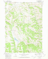
 1980 Rock Lake Peak1980 Print · USGSThe high wilderness of Lincoln County comes into focus in this late twentieth-century study of the Salt River Range. Trace the network of Pack Trails connecting remote landmarks like Rock Lake Peak, Mc Dougal Pass, and the high waters of Lake Barstow.2 unique versions available
 - 1980 Map of Lookout Mountain
 1980 Lookout Mountain1980 Print · USGSThe Wyoming high country is surveyed here in the early 1980s, revealing a landscape defined by forest boundaries and mountain passes. Trace the remote network of a Pack Trail and Jeep Trail leading to a mine and the heights of Gunsight Pass.2 unique versions available
 - 1980 Map of Thayne East, 1981 Print
 1980 Thayne East1981 Print · USGSStar Valley ranching and irrigation are captured here in the early 1980s as the communities of Thayne and Bedford grew along the Salt River. Researchers can trace local landmarks like the Bedford Cem, Holdaway Sch, and the network of water-moving systems like the Hardman Ditch.
 - 1980 Map of Afton, 1984 Print
 1980 Afton1984 Print · USGSStar Valley ranching and early migration routes come together in this Wyoming survey from the early eighties. Researchers can trace the Emigrant Salt River Trail and Lander Cutoff near settlements like Afton and Fairview.
 - 1981 Map of Jackson
 1981 Jackson1981 Print · USGSThe high valleys and peaks surrounding Jackson were undergoing subtle transitions in the early eighties. Genealogists and researchers can trace old mountain outposts like Bondurant, the location of Camp Davis, and the roads leading to Astoria Mineral Hot Springs.
 - 1982 Map of Fontenelle Reservoir
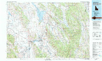
 1982 Fontenelle Reservoir1982 Print · USGSWestern Wyoming's high country is captured here during the early eighties, showing the intersection of historic pioneer routes and modern water management. Genealogists and historians can trace the Emigrant Trail, Sublette Cutoff, and old sites like Rainbow Camp.2 unique versions available
 - 1982 Map of Afton
 1982 Afton1982 Print · USGSWestern Wyoming during the early eighties shows a landscape of mountain ranges and valley settlements. Genealogists can trace family names and small towns across Star Valley, while historians can locate the path of the Lander Cutoff and the Cottonwood Mine.
 - 1982 Map of Soda Springs
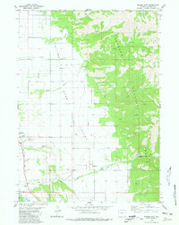
 1982 Soda Springs1982 Print · USGSSoutheast Idaho and the Wyoming borderlands come alive in the early eighties as a landscape of mountain ranges and industrial valleys. Genealogists and historians can locate remote family plots like Lund Cem or trace the early paths through Fivemile Meadows and the Fort Hall Indian Reservation.2 unique versions available
 - 1983 Map of Preston
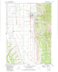
 1983 Preston1983 Print · USGSSoutheast Idaho and the tri-state border region thrived on a mix of mountain agriculture and rail transport in the early eighties. Genealogists and historians can trace the Union Pacific corridor through Preston or locate family landmarks in Mound Valley and Paris.
Showing maps 1-25 of 39
Top cities of Lincoln County
- Kemmerer historical maps
- Afton historical maps
- Star Valley Ranch historical maps
- Alpine historical maps
- Diamondville historical maps
- Cokeville historical maps
See more
Frequently asked questions
- What are the different types of historical maps available for Lincoln County?
- What is the oldest map of Lincoln County?
- Where can I purchase historical maps of Lincoln County for my home or office?
- Where can I download high-res historical maps of Lincoln County?
- Are there historical topographic maps available for Lincoln County?
- Is there historical aerial imagery available for Lincoln County?
- Where are historical maps of Lincoln County sourced from?