1980s Maps of Platte County, Wyoming
Explore 6 historic maps of Platte County from the 1980s. These maps offer a rare glimpse into what life looked like during the 1980s — showing old roads, neighborhoods, homes, and landmarks that have changed or disappeared over time.
Whether you're researching your family's past, planning a metal detecting trip, or studying how Platte County's landscape evolved across the 1980s, these high-resolution maps are a powerful tool for exploring the history of this region.
- Focus on a specific era: All maps on this page are from the 1980s, giving you a focused view of this time period.
- See what’s changed: Compare century-old streets, trails, and buildings to today's modern landscape using overlays and satellite layers.
- Research with precision: Use these maps for genealogy, historical research, land use analysis, or educational projects.
- View, download, or print: Maps are fully viewable online in high resolution, and can be downloaded or printed for your own records.
Start exploring Platte County's history through authentic maps from the 1980s. This is your window into the past.
Platte County, WY maps
(6)- 1981 Map of Douglas
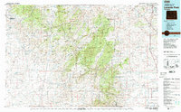
 1981 Douglas1981 Print · USGSThe North Platte River corridor in the early eighties shows a landscape shaped by energy and iron. Genealogists and industrial historians can trace rail-side settlements like Glenrock, explore the Big Muddy Oil Field, and locate the old siding at Fetterman.
 - 1981 Map of Laramie Peak
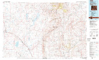
 1981 Laramie Peak1981 Print · USGSThe Laramie Mountains and Medicine Bow National Forest define this landscape in the early eighties. Genealogists and historians can trace high-country settlements like Toltec and Binford, or locate industrial sites like the Mica Mine near the North Laramie River.2 unique versions available
 - 1982 Map of Rock River
 1982 Rock River1982 Print · USGSThe Laramie Basin and the rugged peaks of the high plains come into focus in the early eighties. Genealogists and historians can trace rail-aligned settlements like Rock River and Bosler, alongside hydraulic landmarks like Wheatland Reservoir No 2.
 - 1982 Map of Lusk, 1983 Print
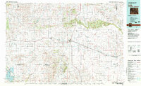 1982 Lusk1983 Print · USGSNiobrara County and the surrounding high plains are shown in the early eighties as the Chicago and North Western line linked remote cattle towns. Researchers can trace the path of the Niobrara River or locate community hubs like Node, Keeline, and Prairie Center.
 - 1985 Map of Harris Park
 1985 Harris Park1985 Print · USGSThe Laramie Mountains of southeastern Wyoming are documented here in the mid-eighties, centered on the high-altitude clearings of Harris Park. Local historians and hikers can trace the remote tracks across 4WD Ridge and find landmarks like Albany Peak and Harmon Heights.
 - 1985 Map of Esterbrook
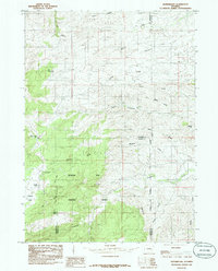 1985 Esterbrook1985 Print · USGSThe Laramie Mountains backcountry of southeastern Wyoming is captured here in the mid-1980s. Researchers can locate the settlement of Esterbrook, trace the high slopes of Elk Mountain, and find local landmarks like Castle Rock and the Mine.
End of results
Showing maps 1-6 of 6
Top cities of Platte County
- Wheatland historical maps
- Guernsey historical maps
- Chugwater historical maps
- Glendo historical maps
- Hartville historical maps
Frequently asked questions
- What are the different types of historical maps available for Platte County?
- What is the oldest map of Platte County?
- Where can I purchase historical maps of Platte County for my home or office?
- Where can I download high-res historical maps of Platte County?
- Are there historical topographic maps available for Platte County?
- Is there historical aerial imagery available for Platte County?
- Where are historical maps of Platte County sourced from?