Old Maps of Platte County, Wyoming for Genealogy
Trace your family roots with 153 historic maps of Platte County. These high-res maps reveal old neighborhoods, homesites, landmarks, and streets — helping you uncover where your ancestors lived and how the area evolved over time.
- Explore historic neighborhoods: Identify where your relatives may have lived in the 1800s or 1900s.
- Compare maps over time: Trace the changes in streets, buildings, and landmarks for multi-generational research.
- Perfect for genealogy & ancestry research: Used by family historians and researchers to map out lineage and migration.
These maps are an incredible resource for exploring your personal connection to Platte County's past.
Platte County, WY maps
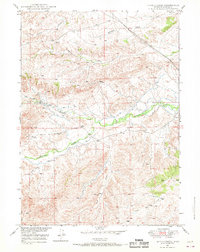
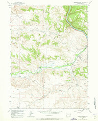
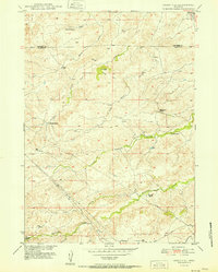
(153)- 1896 Map of Hartville
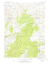
 1896 Hartville1896 Print · USGSSoutheast Wyoming in the late nineteenth century was a territory of vital river crossings and early industry. Researchers can trace the junction of the Laramie River and North Platte River near Fort Laramie and locate early rail hubs at Wheatland and Wendover.
 - 1901 Map of Hartville
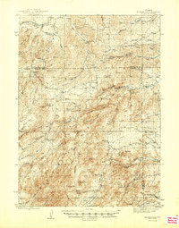
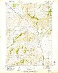
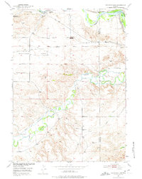
 1901 Hartville1901 Print · USGSEastern Wyoming at the turn of the century reveals a landscape defined by the arrival of the rails and the legacy of the frontier. Genealogists can trace family ranching sites like Dotys Ranch or early towns such as Hartville and Fort Laramie.2 unique versions available
 - 1943 Map of Esterbrook, 1963 Print
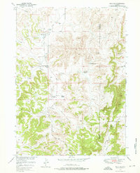
 1943 Esterbrook1963 Print · USGSThe Laramie Range high country comes into focus in the early 1940s, showing a landscape of remote mountain ranches and forest lookouts. Researchers can trace historic family holdings like La Bonte Ranch and find small rural schoolhouses such as Morton Sch and Hanks Sch.
 - 1945 Map of Esterbrook
 1945 Esterbrook1945 Print · USGSThe Converse and Albany county line in the 1940s reveals a high-plains landscape of remote mountain schools and family ranches. Genealogists can locate family landmarks like La Bonte Ranch and Morton Sch or trace the old Horseshoe Trail.2 unique versions available
 - 1949 Map of Cedar Top, 1963 Print
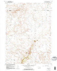 1949 Cedar Top1963 Print · USGSThe Platte and Niobrara county line runs through this Wyoming landscape in the late 1940s. Local history researchers can trace landmarks like the Spanish Diggings, Sheep Mountain, and the unique Spouting Spring.2 unique versions available
 - 1949 Map of Cedar Hill, 1967 Print
 1949 Cedar Hill1967 Print · USGSRanching life on the Converse and Platte county line is documented here during the late 1940s, showing a landscape defined by water and wind. Researchers can trace the heritage of the Fitzhugh Ranch or locate water sources like Bog Hole Springs and North Elkhorn Creek.2 unique versions available
 - 1949 Map of Spring Creek, 1970 Print
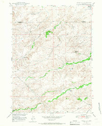
 1949 Spring Creek1970 Print · USGSIn the late 1940s, this Wyoming ranching landscape relied on a critical network of water management and seasonal drainages. Researchers can trace the early irrigation patterns of Horseshoe Creek and locate family-named landmarks like Pollard Hill and Reeder Draw.2 unique versions available
 - 1949 Map of Dilts Ranch, 1975 Print
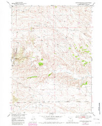
 1949 Dilts Ranch1975 Print · USGSCentral Wyoming ranching country is documented here just after the war, where the historic Emigrant Trail crosses the high plains. Researchers can trace the wagon route past the Oregon Trail Monument or locate early family holdings like Dilts Ranch and Elkhorn Ranch.
 - 1950 Map of Glendo
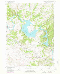
 1950 Glendo1950 Print · USGSThe high plains of eastern Wyoming are captured here in the post-war era as the rail-and-river economy centered on the North Platte River matured. Genealogists and historians can trace the early layout of Glendo and locate vanished siding stops like Bona along the Chicago Burlington and Quincy tracks.
 - 1950 Map of Spring Creek
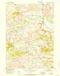
 1950 Spring Creek1950 Print · USGSPlatte County ranching country is captured here at mid-century during the Missouri River Basin development project. Genealogists and historians can trace old water rights and livestock improvements along Horseshoe Creek, Whiskey Gulch, and several Windmill sites.
 - 1950 Map of Cedar Top
 1950 Cedar Top1950 Print · USGSThe high plains of eastern Wyoming are captured here at mid-century, straddling the border of Niobrara and Platte counties. Researchers can trace the ranching landscape through landmarks like Spanish Diggings and the elevations of Sheep Mountain and Horse Tooth.
 - 1950 Map of Jewel Springs
 1950 Jewel Springs1950 Print · USGSThe high plains of eastern Wyoming are captured here in the mid-century, where the North Platte River meets a rugged landscape of ranching and conservation. Researchers can locate numerous family-named landmarks and water sources like Jewel Springs, Buck Spring, and the Haystack Mountain State Game Preserve.
 - 1950 Map of Dilts Ranch
 1950 Dilts Ranch1950 Print · USGSThe Converse and Platte County line at the mid-century reveals a ranching landscape still defined by pioneer history. Genealogists and historians can trace the Old Oregon Trail past the Oregon Trail Monument and locate family holdings like Dilts Ranch.
 - 1950 Map of Guernsey, 1952 Print
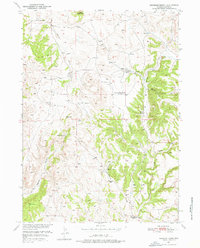
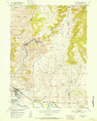 1950 Guernsey1952 Print · USGSThe mining and ranching corridors of Platte County come to life in the mid-century, showing the industrial pulse of the Sunrise and Hartville districts. Trace the physical legacy of the Oregon Trail alongside active rail lines and mines like the Chicago Mine.4 unique versions available
 - 1950 Map of Coleman Butte, 1963 Print
 1950 Coleman Butte1963 Print · USGSMid-century ranching life in Platte County centers on family-held lands and high plains landmarks like Coleman Butte. Genealogists can trace localized social hubs and homesteads such as the Cottonwood Community Hall, Harry Coleman Ranch, and Willadsen Ranch.3 unique versions available
 - 1950 Map of Herman Ranch, 1973 Print
 1950 Herman Ranch1973 Print · USGSPlatte County ranching and the path of the pioneers meet in this mid-century survey of the Wyoming landscape. Genealogists and historians can trace the Emigrant Trail across the hills, locating an Oregon Trail Marker and family sites like Herman Ranch.3 unique versions available
 - 1950 Map of Register Cliff, 1975 Print
 1950 Register Cliff1975 Print · USGSThe North Platte and Laramie rivers converge here during the mid-twentieth century, an area deeply layered with frontier history and irrigation infrastructure. Researchers can trace the path of the Oregon Trail past the Register Cliff Monument (Historical), the Pony Express Sta, and the Old Guernsey Ranch.2 unique versions available
 - 1950 Map of Haushar Ranch, 1976 Print
 1950 Haushar Ranch1976 Print · USGSPlatte County ranching life is preserved here at mid-century, documenting the family-named spreads and schools that anchored this high-plains landscape. Trace the history of local education at Canyon View School or locate the historic sites of McNutt Ranch and Haushar Ranch.2 unique versions available
 - 1950 Map of Hell Gap, 1976 Print
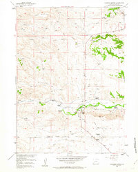
 1950 Hell Gap1976 Print · USGSThe high plains of Platte and Goshen counties come into focus during the early fifties, showing a land of remote ranches and early industrial infrastructure. Trace family names and local landmarks like the Old 4J Ranch, Muthart Place, and the Patten Creek Sch (Aband).3 unique versions available
 - 1950 Map of Guernsey Reservoir, 1978 Print
 1950 Guernsey Reservoir1978 Print · USGSMid-century Platte County reveals the intersection of pioneer migration and modern reclamation projects along the North Platte. Researchers can trace the Emigrant Trail past local landmarks like Frederick Ranch and the Lucindy Rollins Grave.2 unique versions available
 - 1950 Map of Cottonwood Falls, 1982 Print
 1950 Cottonwood Falls1982 Print · USGSThe high plains of Platte County meet the timbered edge of the Medicine Bow National Forest in this mid-century survey. Genealogists and historians can trace local water rights and landmarks such as Cottonwood Falls, Matilda Creek, and the route of Fletcher Park Road.2 unique versions available
 - 1951 Map of Coleman Butte
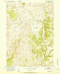
 1951 Coleman Butte1951 Print · USGSPlatte County ranching life is captured here in the early fifties, showcasing a landscape of family-owned spreads and community hubs. Trace local genealogy and land use at the Cottonwood Community Hall or across the H B Coleman Ranch and Willadsen Ranch.
 - 1951 Map of Sibley Peak
 1951 Sibley Peak1951 Print · USGSThe high plains of Platte County come into focus during the early fifties, showing a landscape defined by ranching and historic trails. Researchers can locate the Oregon Trail Marker, follow the Chicago Burlington and Quincy RR, and trace water sources like Downey Reservoir Number One.
 - 1951 Map of Haushar Ranch
 1951 Haushar Ranch1951 Print · USGSThe ranching landscape of Platte County comes to life in the early fifties, documenting a time of rural transition in the Missouri River Basin. Genealogists can locate family holdings like Haushar Ranch and Osborn Ranch or find the former Canyon View School.
 - 1951 Map of Cedar Hill
 1951 Cedar Hill1951 Print · USGSThe Wyoming ranching country along the Platte and Converse county line is captured here in the early fifties. Genealogists and local historians can trace family landholdings such as Stirrup Ranch and Elkhorn Ranch or locate Bog Hole Springs.
Showing maps 1-25 of 153
Top cities of Platte County
- Wheatland historical maps
- Guernsey historical maps
- Chugwater historical maps
- Glendo historical maps
- Hartville historical maps
Frequently asked questions
- What are the different types of historical maps available for Platte County?
- What is the oldest map of Platte County?
- Where can I purchase historical maps of Platte County for my home or office?
- Where can I download high-res historical maps of Platte County?
- Are there historical topographic maps available for Platte County?
- Is there historical aerial imagery available for Platte County?
- Where are historical maps of Platte County sourced from?