1990s Maps of Platte County, Wyoming
Explore 28 historic maps of Platte County from the 1990s. These maps offer a rare glimpse into what life looked like during the 1990s — showing old roads, neighborhoods, homes, and landmarks that have changed or disappeared over time.
Whether you're researching your family's past, planning a metal detecting trip, or studying how Platte County's landscape evolved across the 1990s, these high-resolution maps are a powerful tool for exploring the history of this region.
- Focus on a specific era: All maps on this page are from the 1990s, giving you a focused view of this time period.
- See what’s changed: Compare century-old streets, trails, and buildings to today's modern landscape using overlays and satellite layers.
- Research with precision: Use these maps for genealogy, historical research, land use analysis, or educational projects.
- View, download, or print: Maps are fully viewable online in high resolution, and can be downloaded or printed for your own records.
Start exploring Platte County's history through authentic maps from the 1990s. This is your window into the past.
Platte County, WY maps
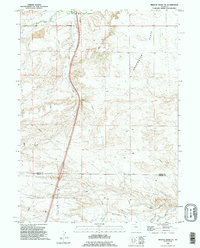
(28)- 1990 Map of Guernsey, 1995 Print
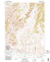 1990 Guernsey1995 Print · USGSIron mining and military history converge in the late twentieth century along the North Platte. Trace family homesteads and industrial roots at Sunrise, the Good Fortune Mine, and the famous Oregon Trail Ruts.
 - 1990 Map of C S Ranch, 1995 Print
 1990 C S Ranch1995 Print · USGSSoutheast Wyoming ranching lands appear here in the late twentieth century, showing the meeting point of Platte, Goshen, and Laramie counties. Genealogists and historians can trace family-named holdings like the C S Ranch and A X Ranch alongside Bear Creek.
 - 1990 Map of Klutz Canyon, 1995 Print
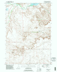
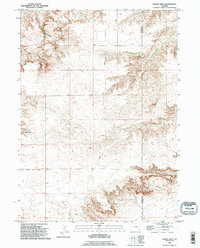
 1990 Klutz Canyon1995 Print · USGSPlatte and Goshen Counties are captured here in the 1990s, showing a rugged landscape of high flats and deep canyon drainages. Researchers can trace rural life through landmarks like Eastwood, the lonely Cem in the southwest, and numerous Springs tucked into Klutz Canyon.
 - 1990 Map of Register Cliff, 1995 Print
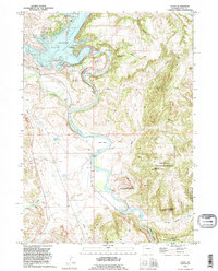
 1990 Register Cliff1995 Print · USGSSoutheastern Wyoming's pioneer heritage is centered here in the 1990s, where the historic path of westward migration meets modern water engineering. Trace the Oregon Trail to Register Cliff or locate the site of the Pony Express Station near the North Platte River.
 - 1990 Map of Antelope Gap, 1995 Print
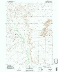
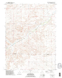
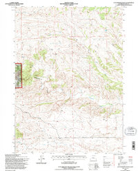
 1990 Antelope Gap1995 Print · USGSThe high plains of Platte County come into focus in the 1990s as the Laramie River basin and Grayrocks Reservoir define the local ranching landscape. Genealogists and researchers can trace historical access routes like Antelope Gap Road and find remote landmarks including Eagles Nest Spring and Antelope Gap.
 - 1990 Map of Wheatland, 1995 Print
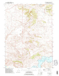
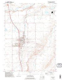 1990 Wheatland1995 Print · USGSWheatland and its surrounding ranchlands are captured here in the 1990s as the town matured into a regional agricultural center. Genealogists and local historians can trace family-named sites like Bard Ranch and Phifer Ranch or locate burials at Wheatland Cemetery.
 - 1990 Map of Dwyer, 1995 Print
 1990 Dwyer1995 Print · USGSThe Platte County plains in the 1990s reveal a landscape of managed water and small rural junctions. Genealogists and local historians can trace family sites near Dwyer, Uva, and the Dwyer Cemetery while following the path of the Laramie River.
 - 1990 Map of Dickinson Hill, 1995 Print
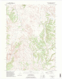
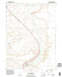
 1990 Dickinson Hill1995 Print · USGSEastern Wyoming's high plains transition across the Goshen Hole Rim in this late twentieth-century survey. Researchers can trace land use through a network of water sources like Mud Springs and ranching landmarks like Baker Ranch.
 - 1990 Map of Bordeaux, 1995 Print
 1990 Bordeaux1995 Print · USGSThe high plains of Platte County come into focus in the 1990s as a landscape shaped by ranching and vital watercourses. Genealogists and local historians can locate legacy operations like Phillips Ranch and M Bar Ranch near the waters of Chugwater Creek.
 - 1990 Map of Wheatland NE, 1995 Print
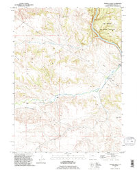
 1990 Wheatland NE1995 Print · USGSPlatte County ranching and military lands are documented here in the 1990s as modern reservoirs meet historic westward routes. Trace family landmarks like the Paul Cundall Ranch or follow the path of the Emigrant Trail near Warm Springs.
 - 1990 Map of Eagles Nest, 1995 Print
 1990 Eagles Nest1995 Print · USGSEastern Wyoming ranching country comes into focus in the early nineties along the Platte and Goshen County line. Local historians and genealogists can trace family-named landmarks and water sources like Cottonwood Spring and the passage through Antelope Gap.
 - 1990 Map of Haushar Ranch, 1995 Print
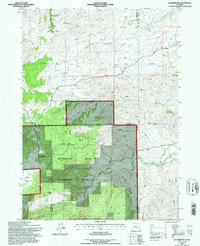
 1990 Haushar Ranch1995 Print · USGSPlatte County ranching and military training are documented here during the 1990s as modern land use overlaps with historic homesteads. Trace family landholdings and terrain at Haushar Ranch, Camp Guernsey, and Sheep Mountain.
 - 1990 Map of Cassa, 1995 Print
 1990 Cassa1995 Print · USGSThe North Platte River valley in Platte County is captured here in the 1990s as it flows past the Camp Guernsey State Military Reservation. Researchers can trace the historic Emigrant Trail or locate family landmarks like Haushar Ranch and the settlement of Cassa.
 - 1990 Map of Whitcomb Hill, 1995 Print
 1990 Whitcomb Hill1995 Print · USGSHigh plains ranching along the Platte and Laramie County line is captured in the early nineties, showing a landscape shaped by water and livestock. Researchers can trace family-named sites like Brinton, Whitcomb Ranch, and Moffett Ranch.
 - 1990 Map of Chugwater, 1995 Print
 1990 Chugwater1995 Print · USGSSoutheastern Wyoming's high plains landscape comes into focus here during the late twentieth century. Researchers can trace the agricultural heart of Chugwater through its Grain Elevators or locate old settlements like Slater and Lathrum.
 - 1990 Map of Herman Ranch, 1995 Print
 1990 Herman Ranch1995 Print · USGSPlatte County ranch lands and military grounds are captured here in the 1990s, where the historic Emigrant Trail still marks the earth. Genealogists can locate Herman Ranch and Russel Ranch while tracing the North Platte River corridor.
 - 1990 Map of Hell Gap, 1995 Print
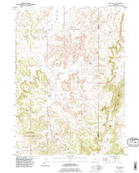 1990 Hell Gap1995 Print · USGSThe high ranch lands of eastern Wyoming are captured here in the 1990s as modern military use met traditional cattle operations. Researchers can trace historic homesteads and remote water sources like Old 4J Ranch, Broom Creek Spring, and the Mothart Place.
 - 1990 Map of Guernsey Reservoir, 1995 Print
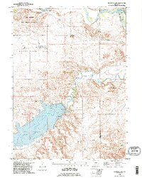
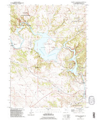 1990 Guernsey Reservoir1995 Print · USGSThe North Platte River corridor in the 1990s reveals a complex layer of western migration history and modern utility. Trace the storied Emigrant Trail past several Oregon Trail Markers and explore the rugged layout of Guernsey State Park.
 - 1990 Map of Double L Ranch, 1995 Print
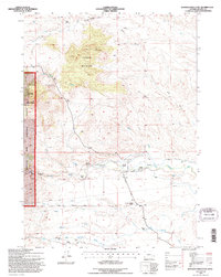
 1990 Double L Ranch1995 Print · USGSThe high plains of Platte County in the 1990s remained a landscape of isolated family-owned ranching outposts and winding creek beds. Genealogists and historians can trace the locations of the Double L Ranch, Upper McDougal Ranch, and Grant Ranch among the draws.
 - 1990 Map of Ferguson Corner, 1995 Print
 1990 Ferguson Corner1995 Print · USGSThe Platte County high plains come into focus in the 1990s, revealing a landscape of managed water and sparse settlement. Trace the course of the Bordeaux Canal and find landmarks like Ferguson Corner and Herman.
 - 1990 Map of Bristol Ridge NE, 1995 Print
 1990 Bristol Ridge NE1995 Print · USGSThe high plains of Platte and Laramie counties are captured here in the early nineties, showcasing the intersection of ranching land and industrial infrastructure. Researchers can trace the rugged topography from Bristol Ridge down to Chugwater Creek and locate several Oil Well sites.
 - 1992 Map of Cottonwood Falls, 1996 Print
 1992 Cottonwood Falls1996 Print · USGSThe Laramie Mountains transition from forest to open drainage in the early nineties, revealing a landscape defined by seasonal waters. Trace the winding paths of Cottonwood Creek and Crow Creek toward the local landmark at Cottonwood Falls.
 - 1992 Map of Esterbrook, 1996 Print
 1992 Esterbrook1996 Print · USGSThe high country of the Medicine Bow National Forest is documented here in the early nineties, centered on the Converse and Albany county lines. Trace local history through the mountain settlement of Esterbrook, family-named peaks like Reeder Hill, and old Mines.
 - 1992 Map of Harris Park, 1996 Print
 1992 Harris Park1996 Print · USGSHigh in the Laramie Range during the early nineties, this area showcases the secluded mountain communities and rugged drainage basins of Albany County. Researchers can trace remote residential sites like Harmon Heights and Harris Park alongside landmarks like Albany Peak.
 - 1992 Map of Johnson Mountain, 1996 Print
 1992 Johnson Mountain1996 Print · USGSPlatte County ranching and water rights are recorded here in the early nineties, showing a landscape of family homesteads and irrigation systems. Genealogists can trace family landmarks like Butner Ranch, the Sommers-Shockley School, and the Black Powder Mines.
Showing maps 1-25 of 28
Top cities of Platte County
- Wheatland historical maps
- Guernsey historical maps
- Chugwater historical maps
- Glendo historical maps
- Hartville historical maps
Frequently asked questions
- What are the different types of historical maps available for Platte County?
- What is the oldest map of Platte County?
- Where can I purchase historical maps of Platte County for my home or office?
- Where can I download high-res historical maps of Platte County?
- Are there historical topographic maps available for Platte County?
- Is there historical aerial imagery available for Platte County?
- Where are historical maps of Platte County sourced from?