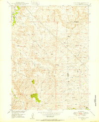
1950 Map of Dilts Ranch
USGS Topo · Published 1950About this map
Old Oregon Trail tracks through the high plains of the Converse and Platte County border, marking a landscape defined by historic migration and ranching. Surveyed in the late 1940s, this map documents the cattle-country economy centered around the Dilts Ranch along La Bonte Creek and the Elkhorn Ranch situated near the headwaters of Elkhorn Creek. The cartography captures the literal markers of the westward expansion, specifically identifying an Oregon Trail Monument and the various paths that diverged across the arid terrain. While the geography is shaped by drainages like Sand Creek and Indian Creek, the 20th-century imprint is visible through the infrastructure of Pipe Lines and scattered features like a Windmill, illustrating how the land was adapted for modern use while preserving the physical memory of the pioneer trail.
Find a feature on this map
14 named features on this map. Tap any name to fly to it.
Don’t see what you’re looking for? This feature index may not catch every label — zoom into the map to look around manually.
Map Details
Editions of this 1950 Dilts Ranch Map
This is the sole edition of this map. No revisions or reprints were ever made.
Other maps of this area

1943 · Esterbrook
USGS Topo · 1:62,500

1945 · Esterbrook
USGS Topo · 1:62,500

1949 · Irvine
USGS Topo · 1:24,000

1949 · Poison Lake
USGS Topo · 1:24,000

1949 · Cedar Hill
USGS Topo · 1:24,000

1949 · Spring Creek
USGS Topo · 1:24,000

1949 · Dilts Ranch
USGS Topo · 1:24,000

1949 · Chalk Buttes
USGS Topo · 1:24,000

1949 · Orin
USGS Topo · 1:24,000

1950 · Spring Creek
USGS Topo · 1:24,000