
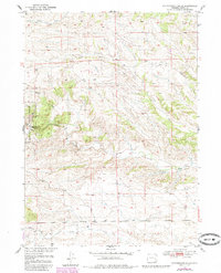
1950 Map of Cottonwood Falls
USGS Topo · Published 1982About this map
Medicine Bow National Forest defines the western edge of this Wyoming landscape, where the high plains meet the transition to more broken terrain. This 1950 survey, updated in the early 1980s, documents a network of seasonal watercourses and draws that have shaped the ranching and timber history of Platte County. The namesake Cottonwood Falls sits along Cottonwood Creek, a primary drainage that flows eastward through the quadrangle. Early infrastructure is represented by the Fletcher Park Road and an isolated Tunnel, while the presence of a Windmill indicates the ongoing reliance on groundwater for livestock. The map records a series of named creeks including Crow Creek, Sand Draw, and Matilda Creek, which illustrate the complex local hydrology. This edition reflects the Missouri River Basin development program, capturing the intersection of federal land management and rural land use during the mid-20th century.
Find a feature on this map
11 named features on this map. Tap any name to fly to it.
Don’t see what you’re looking for? This feature index may not catch every label — zoom into the map to look around manually.
Map Details
Editions of this 1950 Cottonwood Falls Map
2 editions found
Other maps of this area

1943 · Esterbrook
USGS Topo · 1:62,500

1945 · Esterbrook
USGS Topo · 1:62,500

1949 · Spring Creek
USGS Topo · 1:24,000

1950 · Spring Creek
USGS Topo · 1:24,000

1950 · Coleman Butte
USGS Topo · 1:24,000

1951 · Coleman Butte
USGS Topo · 1:24,000

1951 · Sibley Peak
USGS Topo · 1:24,000

1951 · Cottonwood Falls
USGS Topo · 1:24,000

1953 · Lewis Flat
USGS Topo · 1:24,000

1953 · Johnson Mountain
USGS Topo · 1:24,000