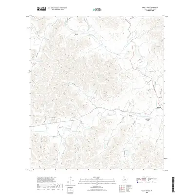
2019 Map of A Bar A Ranch
USGS Topo · Published 2019About this map
The confluence of the N Prong Medina River and the W Prong Medina River defines this portion of the Texas Hill Country, centered near the community of Medina. The map reveals a landscape heavily influenced by ranching and local family histories, evidenced by numerous private burial grounds scattered across the terrain. Genealogists may find interest in the locations of the Means Cem, Goodman Cem, and Baker Cem. The geography is marked by significant elevation changes, with watercourses like Pecan Cr and Elm Cr cutting through the limestone hills. Modern infrastructure, including the Cinco B Ranch Airport and the eponymous A Bar A Ranch, sits alongside historic routes such as FM 337e and FM 2107. Notable water features include Thompson Lake and Gallant Lake, which provide a contrast to the surrounding terrain of Dewberry Hollow and Wet Hollow.
Find a feature on this map
48 named features on this map. Tap any name to fly to it.
Don’t see what you’re looking for? This feature index may not catch every label — zoom into the map to look around manually.
Map Details
Editions of this 2019 A Bar A Ranch Map
This is the sole edition of this map. No revisions or reprints were ever made.
Other maps of this area

1954 · San Antonio
USGS Topo · 1:250,000

1956 · Tarpley
USGS Topo · 1:62,500

1956 · Tuff
USGS Topo · 1:62,500

1956 · Bandera
USGS Topo · 1:62,500

1956 · Center Point
USGS Topo · 1:62,500

1957 · San Antonio
USGS Topo · 1:250,000

1964 · Diamond S Ranch
USGS Topo · 1:24,000

1964 · Echo Hill Ranch
USGS Topo · 1:24,000
1964 · Love Creek
USGS Topo · 1:24,000

1964 · Rock Cliff Reservoir
USGS Topo · 1:24,000