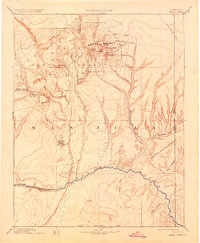
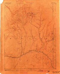
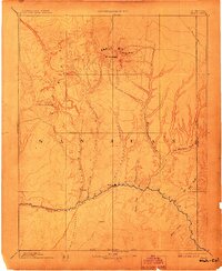
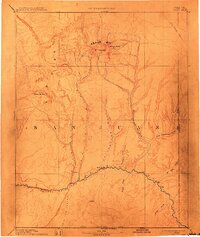
1893 Map of Abajo
USGS Topo · Published 1931About this map
Abajo Mts dominate this landscape of the Four Corners region, surveyed by Henry Gannett and the Hayden Surveys during the late nineteenth century. The settlement of Bluff City sits along the northern bank of the San Juan River, representing a remote outpost in San Juan County just above the Navajo Indian Reservation boundary. High peaks including Mt Linnaeus and Abajo Peak rise above a complex network of drainages such as Cottonwood Wash and Recapture Creek, illustrating the difficult terrain encountered by early travelers.
Find a feature on this map
41 named features on this map. Tap any name to fly to it.
Don’t see what you’re looking for? This feature index may not catch every label — zoom into the map to look around manually.
Map Details
Editions of this 1893 Abajo Map
5 editions found

Other maps of this area

1883 · Marsh Pass
USGS Topo · 1:250,000

1885 · San Rafael
USGS Topo · 1:250,000

1885 · La Sal
USGS Topo · 1:250,000

1886 · Henry Mountains
USGS Topo · 1:250,000

1886 · Abajo
USGS Topo · 1:250,000

1889 · Chaco
USGS Topo · 1:250,000

1892 · Marsh Pass
USGS Topo · 1:250,000

1892 · Abajo
USGS Topo · 1:250,000

1892 · Henry Mountains
USGS Topo · 1:250,000

1892 · Chaco
USGS Topo · 1:250,000