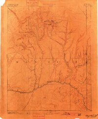
1893 Map of Abajo
USGS Topo · Published 1901About this map
Bluff City stands as a primary settlement along the winding course of the San Juan River in this late 19th-century reconnaissance. The landscape is defined by the high elevations of the Abajo Mts, where prominent summits like Abajo Peak and Mt Linnaeus overlook the drainage systems of Cottonwood Wash and Montezuma Creek. To the north, the historic route of the Old Spanish Trail cuts across the plateau, marking a corridor of early travel and commerce long before modern highways.
Find a feature on this map
24 named features on this map. Tap any name to fly to it.
Don’t see what you’re looking for? This feature index may not catch every label — zoom into the map to look around manually.
Map Details
Editions of this 1893 Abajo Map
5 editions found

Other maps of this area

1883 · Marsh Pass
USGS Topo · 1:250,000

1885 · San Rafael
USGS Topo · 1:250,000

1885 · La Sal
USGS Topo · 1:250,000

1886 · Henry Mountains
USGS Topo · 1:250,000

1886 · Abajo
USGS Topo · 1:250,000

1889 · Chaco
USGS Topo · 1:250,000

1892 · Marsh Pass
USGS Topo · 1:250,000

1892 · Abajo
USGS Topo · 1:250,000

1892 · Henry Mountains
USGS Topo · 1:250,000

1892 · Chaco
USGS Topo · 1:250,000