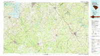
1979 Map of Abbeville
USGS Topo · Published 1980About this map
The Abbeville region of South Carolina, extending across the Savannah River into Georgia, is defined by its industrial rail corridors and the sprawling waters of Hartwell Lake and Lake Greenwood. By the late 1970s, the landscape was a mix of established textile and mill towns such as Ware Shoals and Honea Path and the expansive protected timberlands of the Sumter National Forest. The map documents the intricate rail network of the Seaboard Coast Line and Southern Railway, which historically fueled the economic development of inland communities like Due West and Ninety Six. A notable concentration of islands, including Paris Island and Bushrod Island, appears within the reservoir reaches, while small settlements such as Promised Land and Mount Carmel reflect the rural social history of the Piedmont. Transport hubs like Hester Memorial Airport and County Airport mark the era's transition toward modernized infrastructure alongside the older river-and-rail economy.
Find a feature on this map
103 named features on this map. Tap any name to fly to it.
Don’t see what you’re looking for? This feature index may not catch every label — zoom into the map to look around manually.
Map Details
Editions of this 1979 Abbeville Map
2 editions found
Other maps of this area

1886 · Walhalla
USGS Topo · 1:125,000

1888 · Pickens
USGS Topo · 1:125,000

1891 · Carnesville
USGS Topo · 1:125,000

1892 · Mc Cormick
USGS Topo · 1:125,000

1892 · Walhalla
USGS Topo · 1:125,000

1892 · Abbeville
USGS Topo · 1:125,000

1893 · Elberton
USGS Topo · 1:125,000

1894 · Pickens
USGS Topo · 1:125,000

1896 · Walhalla
USGS Topo · 1:125,000

1906 · Crawfordville
USGS Topo · 1:125,000