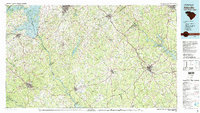
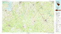
1979 Map of Abbeville
USGS Topo · Published 1980About this map
Sumter National Forest occupies a significant portion of this landscape, anchoring a region defined by its complex river systems and developing mid-century infrastructure. The Savannah River serves as a prominent boundary, its flow regulated by the Hartwell Dam and widening into the expansive Hartwell Lake and Clark Hill Lake. These reservoirs reshape the river's character, surrounding islands like Greene Island and Stephensons Island.
Find a feature on this map
123 named features on this map. Tap any name to fly to it.
Don’t see what you’re looking for? This feature index may not catch every label — zoom into the map to look around manually.
Map Details
Editions of this 1979 Abbeville Map
2 editions found
Other maps of this area

1886 · Walhalla
USGS Topo · 1:125,000

1888 · Pickens
USGS Topo · 1:125,000

1891 · Carnesville
USGS Topo · 1:125,000

1892 · Mc Cormick
USGS Topo · 1:125,000

1892 · Walhalla
USGS Topo · 1:125,000

1892 · Abbeville
USGS Topo · 1:125,000

1893 · Elberton
USGS Topo · 1:125,000

1894 · Pickens
USGS Topo · 1:125,000

1896 · Walhalla
USGS Topo · 1:125,000

1906 · Crawfordville
USGS Topo · 1:125,000