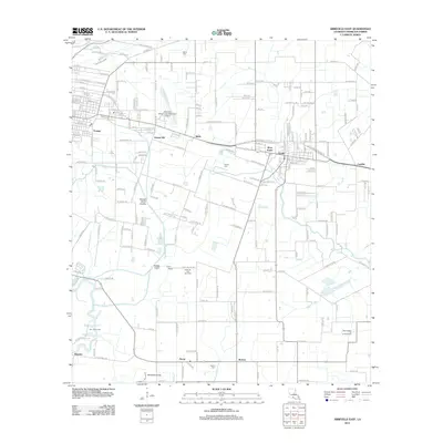
2012 Map of Abbeville East
USGS Topo · Published 2012About this map
The Vermilion River snakes along the western edge of this landscape, anchoring a network of waterways and drainage channels including Valcourt Coulee and Youngs North Coulee. This coastal Louisiana terrain is defined by its deep ties to the energy industry, notably the Erath Oil and Gas Field and the Tigre Lagoon Oil and Gas Field located near the southern marshlands. The mapping captures a transition from the denser residential streets of Erath and Youngs to the agricultural expanses and small communities of Henry and Boston. Local history is preserved through several family and community burial grounds, such as Trahan Cem and Bares Cem, scattered among the rural roads. Transportation infrastructure is anchored by the Abbeville Chris Crusta Memorial Airport and a grid of canals like the Youngs Canal, reflecting the area's essential hydraulic and maritime economy.
Find a feature on this map
207 named features on this map. Tap any name to fly to it.
Don’t see what you’re looking for? This feature index may not catch every label — zoom into the map to look around manually.
Map Details
Editions of this 2012 Abbeville East Map
This is the sole edition of this map. No revisions or reprints were ever made.
Other maps of this area

1932 · Abbeville SW
USGS Topo · 1:31,680

1932 · Abbeville SE
USGS Topo · 1:31,680

1932 · Abbeville NE
USGS Topo · 1:31,680

1932 · Abbeville NW
USGS Topo · 1:31,680

1937 · Derouen
USGS Topo · 1:62,500

1939 · St. Martinsville
USGS Topo · 1:62,500

1945 · New Orleans
USGS Topo · 1:250,000

1946 · Milton
USGS Topo · 1:31,680

1946 · Leroy
USGS Topo · 1:31,680

1952 · Lake Charles
USGS Topo · 1:250,000