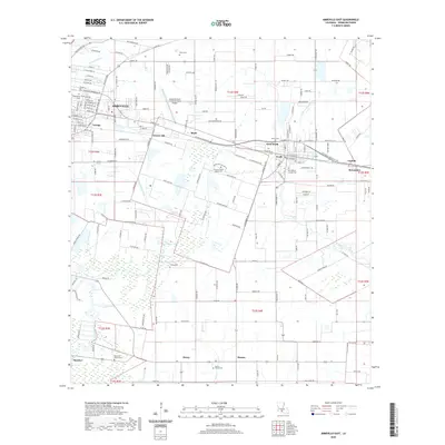
2020 Map of Abbeville East
USGS Topo · Published 2020About this map
Abbeville stands as a primary hub in this portion of Vermilion Parish, where the winding Vermilion River and Valcourt Coulee define the drainage of the coastal prairie. The landscape transition from the developed streets of the parish seat to the agricultural expanses of Grosse Isle and Henry is marked by a network of drainage systems, including the Grant Line Canal and Youngs South Coulee. Local history is deeply etched into the land through numerous small burial grounds and family-named landmarks like Graceland Cem, the Delino Family Cem, and Primeaux Cem. Transportation and commerce are centered around the Abbeville Chris Crusta Memorial Airport and the corridor connecting Erath and Delcambre, reflecting the area's continued reliance on both its waterways and its highway infrastructure. The map also documents smaller rural communities such as Youngs, Mack, and Boston, which maintain distinct identities within the broader alluvial plain.
Find a feature on this map
182 named features on this map. Tap any name to fly to it.
Don’t see what you’re looking for? This feature index may not catch every label — zoom into the map to look around manually.
Map Details
Editions of this 2020 Abbeville East Map
This is the sole edition of this map. No revisions or reprints were ever made.
Other maps of this area

1932 · Abbeville SW
USGS Topo · 1:31,680

1932 · Abbeville SE
USGS Topo · 1:31,680

1932 · Abbeville NE
USGS Topo · 1:31,680

1932 · Abbeville NW
USGS Topo · 1:31,680

1937 · Derouen
USGS Topo · 1:62,500

1939 · St. Martinsville
USGS Topo · 1:62,500

1945 · New Orleans
USGS Topo · 1:250,000

1946 · Milton
USGS Topo · 1:31,680

1946 · Leroy
USGS Topo · 1:31,680

1952 · Lake Charles
USGS Topo · 1:250,000