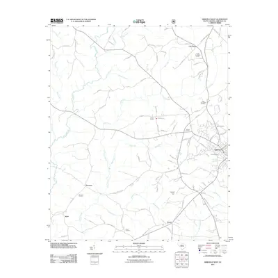
2011 Map of Abbeville West
USGS Topo · Published 2011About this map
Abbeville anchors the eastern edge of this landscape, where the town’s residential streets and cemeteries like Trinity Cemetery and Hobson Cemetery transition into the surrounding Piedmont countryside. The area is defined by a dense network of watercourses, including the Little River and Calhoun Creek, which feed into various branches and creeks such as Redd Creek and Flagreed Creek. This 2011 survey reveals a territory marked by rural clusters and institutional history, notably the Abbeville County Farm located south of the main town. Genealogists will find significant value in the numerous burial grounds documented across the quadrangle, from the Old Zion Cemetery near the center to the Upper Long Cane Cemetery and Melrose Cemetery. Outlying settlements like Cold Spring, Warrenton, and Sharon illustrate the enduring community nodes that persist alongside these waterways, connected by roads such as Rock Hill Rd and Old Calhoun Falls Rd.
Find a feature on this map
95 named features on this map. Tap any name to fly to it.
Don’t see what you’re looking for? This feature index may not catch every label — zoom into the map to look around manually.
Map Details
Editions of this 2011 Abbeville West Map
This is the sole edition of this map. No revisions or reprints were ever made.
Other maps of this area

1892 · Abbeville
USGS Topo · 1:125,000

1893 · Elberton
USGS Topo · 1:125,000

1948 · Abbeville East
USGS Topo · 1:24,000

1948 · Verdery
USGS Topo · 1:24,000

1948 · Abbeville West
USGS Topo · 1:24,000

1949 · Abbeville
USGS Topo · 1:24,000

1949 · Calhoun Creek
USGS Topo · 1:24,000

1950 · Verdery
USGS Topo · 1:24,000

1950 · Abbeville East
USGS Topo · 1:24,000

1954 · Greenville
USGS Topo · 1:250,000