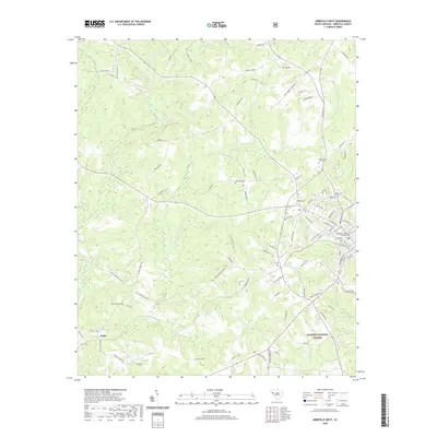
2020 Map of Abbeville West
USGS Topo · Published 2020About this map
The Abbeville County Courthouse serves as the focal point for this western portion of the county seat, where the urban street grid transitions into the wooded ridges of the Sumter National Forest. This landscape is deeply marked by its local history, evidenced by a high density of named burial grounds including Upper Long Cane Cem, Old Zion Cem, and Trinity Cem. The terrain is defined by the winding course of the Little River and its numerous tributaries such as Calhoun Cr and Redd Cr, which carve through the Piedmont hills.
Find a feature on this map
101 named features on this map. Tap any name to fly to it.
Don’t see what you’re looking for? This feature index may not catch every label — zoom into the map to look around manually.
Map Details
Editions of this 2020 Abbeville West Map
This is the sole edition of this map. No revisions or reprints were ever made.
Other maps of this area

1892 · Abbeville
USGS Topo · 1:125,000

1893 · Elberton
USGS Topo · 1:125,000

1948 · Abbeville East
USGS Topo · 1:24,000

1948 · Verdery
USGS Topo · 1:24,000

1948 · Abbeville West
USGS Topo · 1:24,000

1949 · Abbeville
USGS Topo · 1:24,000

1949 · Calhoun Creek
USGS Topo · 1:24,000

1950 · Verdery
USGS Topo · 1:24,000

1950 · Abbeville East
USGS Topo · 1:24,000

1954 · Greenville
USGS Topo · 1:250,000