
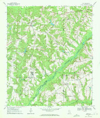
1969 Map of Abbeville West
USGS Topo · Published 1969About this map
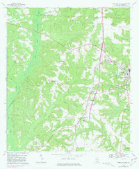
Abbeville serves as the focal point of this Henry County landscape, where the established town grid meets the winding tributaries of the East Fork Choctawhatchee River. During the late 1960s, the area maintained a balance of traditional rural life and mid-century development, evidenced by the numerous country churches like Sardis Ch and Bethlehem Ch situated alongside modern landmarks such as the Drive-in Theater and Radio Tower (WARI).
Find a feature on this map
39 named features on this map. Tap any name to fly to it.
Don’t see what you’re looking for? This feature index may not catch every label — zoom into the map to look around manually.
Map Details
Editions of this 1969 Abbeville West Map
2 editions found
Other maps of this area

1953 · Dothan
USGS Topo · 1:250,000

1954 · Dothan
USGS Topo · 1:250,000

1955 · Dothan
USGS Topo · 1:250,000

1969 · Fort Gaines NW
USGS Topo · 1:24,000
1969 · Texasville
USGS Topo · 1:24,000
1969 · Clopton
USGS Topo · 1:24,000
1969 · Lawrenceville
USGS Topo · 1:24,000

1969 · Abbeville East
USGS Topo · 1:24,000
1969 · Echo
USGS Topo · 1:24,000

1969 · Newville
USGS Topo · 1:24,000