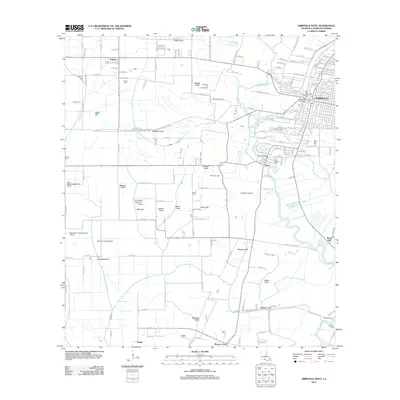
2012 Map of Abbeville West
USGS Topo · Published 2012About this map
The Vermilion River snakes through the heart of this coastal prairie landscape, anchoring the city of Abbeville and the smaller settlements of Perry and Rose Hill. The region's hydraulic engineering is on full display through a dense network of canals, including the Abbeville Canal, Gastinel Canal, and the Bull Hole Canal, which serve the surrounding agricultural and industrial sectors. The presence of the Abbeville Oil and Gas Field and the Perry Gas Field highlights the area's energy economy, while numerous private landing strips like the Schriefer Airstrip and Mouton Landing Strip reflect the logistical needs of this water-rich terrain.
Find a feature on this map
173 named features on this map. Tap any name to fly to it.
Don’t see what you’re looking for? This feature index may not catch every label — zoom into the map to look around manually.
Map Details
Editions of this 2012 Abbeville West Map
This is the sole edition of this map. No revisions or reprints were ever made.
Other maps of this area

1932 · Abbeville SW
USGS Topo · 1:31,680

1932 · Abbeville SE
USGS Topo · 1:31,680

1932 · Abbeville NE
USGS Topo · 1:31,680

1932 · Abbeville NW
USGS Topo · 1:31,680

1946 · Milton
USGS Topo · 1:31,680

1946 · Schooner Bayou SE
USGS Topo · 1:31,680

1946 · Leroy
USGS Topo · 1:31,680

1946 · Schooner Bayou NE
USGS Topo · 1:31,680

1946 · Kaplan
USGS Topo · 1:31,680

1952 · Lake Charles
USGS Topo · 1:250,000