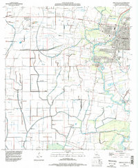
1994 Map of Abbeville West
USGS Topo · Published 1998About this map
The Vermilion River snakes through this low-lying coastal landscape south of Abbeville, defining a region where water management is central to the way of life. By the mid-1990s, the terrain is crisscrossed by an extensive network of infrastructure, including a prominent Aqueduct, numerous siphons, and flumes designed to move water across the coulees and fields. This drainage system supports both traditional agriculture and specialized land use, as seen in the Aquaculture Sites near Perry and the petroleum operations at Abbeville Field.
Find a feature on this map
36 named features on this map. Tap any name to fly to it.
Don’t see what you’re looking for? This feature index may not catch every label — zoom into the map to look around manually.
Map Details
Editions of this 1994 Abbeville West Map
This is the sole edition of this map. No revisions or reprints were ever made.
Other maps of this area

1932 · Abbeville SW
USGS Topo · 1:31,680

1932 · Abbeville SE
USGS Topo · 1:31,680

1932 · Abbeville NE
USGS Topo · 1:31,680

1932 · Abbeville NW
USGS Topo · 1:31,680

1946 · Milton
USGS Topo · 1:31,680

1946 · Schooner Bayou SE
USGS Topo · 1:31,680

1946 · Leroy
USGS Topo · 1:31,680

1946 · Schooner Bayou NE
USGS Topo · 1:31,680

1946 · Kaplan
USGS Topo · 1:31,680

1952 · Lake Charles
USGS Topo · 1:250,000