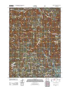
2011 Map of Abbott Butte
USGS Topo · Published 2011About this map
Abbott Butte Lookout stands as the central landmark of this high-elevation landscape, where the Rogue River-Siskiyou National Forest is crisscrossed by a network of timber and development roads. The 2011 survey reveals a geography defined by seasonal outposts and camps such as Cow Camp, Five Sticks Camp, and Freddy Camp, which likely support the regions ranching or forestry operations. The terrain is marked by significant physical landmarks including Quartz Mountain, the expansive Donegan Prairies, and the massive scar of the Buck Basin Burn in the south. An intricate drainage system feeds into Abbott Creek and its various forks, while specialized recreational sites like Huckleberry Lake Campground and Neal Springs Campground illustrate the area's transition into a modern recreational destination. Traces of earlier industry remain visible in the nomenclature of roads like Old Buzzard Mine Rd.
Find a feature on this map
63 named features on this map. Tap any name to fly to it.
Don’t see what you’re looking for? This feature index may not catch every label — zoom into the map to look around manually.
Map Details
Editions of this 2011 Abbott Butte Map
This is the sole edition of this map. No revisions or reprints were ever made.
Other maps of this area

1891 · Ashland
USGS Topo · 1:250,000

1893 · Ashland
USGS Topo · 1:250,000

1897 · Ashland
USGS Topo · 1:250,000

1917 · Diamond Lake
USGS Topo · 1:125,000

1944 · Abbott Butte
USGS Topo · 1:62,500

1947 · Abbott Butte
USGS Topo · 1:62,500

1955 · Quartz Mtn
USGS Topo · 1:62,500

1955 · Medford
USGS Topo · 1:250,000

1956 · Garwood Butte
USGS Topo · 1:62,500

1956 · Prospect
USGS Topo · 1:62,500