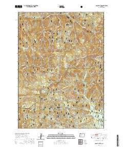
2020 Map of Abbott Butte
USGS Topo · Published 2020About this map
Abbott Butte and the high ridges of the Rogue-Umpqua Divide anchor this high-elevation landscape along the boundary of Jackson Co and Douglas Co. The terrain is defined by its numerous named peaks and clearings, including Quartz Mtn, Whaleback, and the wide opening at Donegan Prairies. A complex network of Forest Service roads and specialized trails, such as the Golden Stairs Motorcycle and Sunshine Motorcycle routes, traverse the drainage basins of Abbott Cr and McCall Cr. The map reveals a wild interior where high-altitude meadows like Woodruff Meadow and natural water sources like Neal Spring or Huckleberry Lake provided essential landmarks for forest management and recreational access. This area is split between the Umpqua National Forest to the north and the Rogue River National Forest to the south, highlighting the region's long history as protected timber and watershed territory.
Find a feature on this map
50 named features on this map. Tap any name to fly to it.
Don’t see what you’re looking for? This feature index may not catch every label — zoom into the map to look around manually.
Map Details
Editions of this 2020 Abbott Butte Map
This is the sole edition of this map. No revisions or reprints were ever made.
Other maps of this area

1891 · Ashland
USGS Topo · 1:250,000

1893 · Ashland
USGS Topo · 1:250,000

1897 · Ashland
USGS Topo · 1:250,000

1917 · Diamond Lake
USGS Topo · 1:125,000

1944 · Abbott Butte
USGS Topo · 1:62,500

1947 · Abbott Butte
USGS Topo · 1:62,500

1955 · Quartz Mtn
USGS Topo · 1:62,500

1955 · Medford
USGS Topo · 1:250,000

1956 · Garwood Butte
USGS Topo · 1:62,500

1956 · Prospect
USGS Topo · 1:62,500