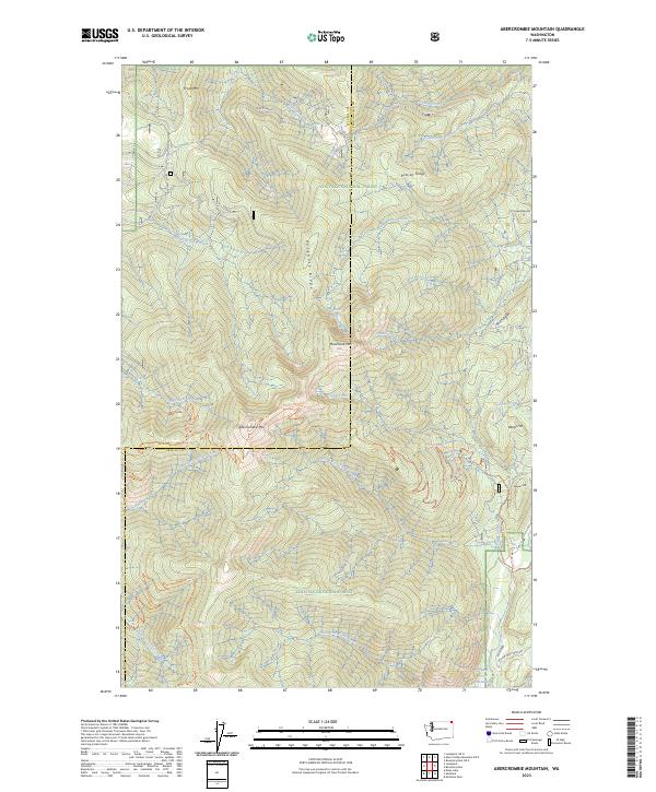
2023 Map of Abercrombie Mountain
USGS Topo · Published 2023About this map
Abercrombie Mtn and Hooknose Mtn dominate this high-elevation landscape within the Colville National Forest, where the county line between Stevens and Pend Oreille counties follows the crest of prominent ridges. The geography is defined by a dense network of high drainage basins, including Flume Creek, Russian Creek, and the East Fork Cedar Creek. Human presence is primarily marked by recreational and industrial infrastructure, such as the Pacific Northwest National Scenic Trail which traverses the central peaks, and the Yellow Head Mine Rd in the southeast corner near the Flume Creek Reservoir. High-altitude features like Hooknose Lake and Frisco Stad/6270 suggest a terrain utilized for both observation and resource management, while the numerous named peaks like Frisco Mtn and Beaver Mtn provide essential landmarks for navigating this complex system of ridges and valleys.
Find a feature on this map
33 named features on this map. Tap any name to fly to it.
Don’t see what you’re looking for? This feature index may not catch every label — zoom into the map to look around manually.
Map Details
Editions of this 2023 Abercrombie Mountain Map
This is the sole edition of this map. No revisions or reprints were ever made.
Other maps of this area

1929 · Colville
USGS Topo · 1:125,000

1933 · Colville
USGS Topo · 1:125,000

1934 · Metaline
USGS Topo · 1:125,000

1942 · Metaline
USGS Topo · 1:125,000

1952 · Deep Lake
USGS Topo · 1:24,000

1952 · Leadpoint
USGS Topo · 1:24,000

1958 · Sandpoint
USGS Topo · 1:250,000

1963 · Sandpoint
USGS Topo · 1:250,000

1967 · Boundary Dam
USGS Topo · 1:24,000

1967 · Metaline
USGS Topo · 1:24,000