
1967 Map of Boundary Dam
USGS Topo · Published 1971About this map
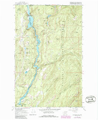
Pend Oreille River flows north toward the Canadian border, dominating this 1967 survey of a landscape defined by industry and conservation. The map captures the infrastructure of the Boundary Dam, including the Vista House, Gaging Station, and various Substations near the river's canyon. Extensive mining operations are documented throughout the hills, from the large Pend Oreille Mine and Josephine Mine in the south to numerous Drill Hole locations and the Lucky Strike Mine along Slate Creek.
Find a feature on this map
68 named features on this map. Tap any name to fly to it.
Don’t see what you’re looking for? This feature index may not catch every label — zoom into the map to look around manually.
Map Details
Editions of this 1967 Boundary Dam Map
2 editions found
Other maps of this area

1934 · Metaline
USGS Topo · 1:125,000

1942 · Metaline
USGS Topo · 1:125,000

1958 · Sandpoint
USGS Topo · 1:250,000

1963 · Sandpoint
USGS Topo · 1:250,000

1967 · Gypsy Peak
USGS Topo · 1:24,000

1967 · Metaline
USGS Topo · 1:24,000

1967 · Metaline Falls
USGS Topo · 1:24,000

1967 · Pass Creek
USGS Topo · 1:24,000
1967 · Abercrombie Mtn
USGS Topo · 1:24,000
1984 · Colville
USGS Topo · 1:100,000