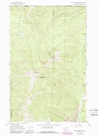
1967 Map of Abercrombie Mtn
USGS Topo · Published 1986About this map
The high ridges of the Colville National Forest dominate this terrain near the Canadian border, where the crests of Hooknose Ridge and Russian Ridge define the drainage of the Colville and Pend Oreille watersheds. At an elevation of over 7,300 feet, Baldy Abercrombie Mtn stands as a prominent landmark above a network of drainages including Flume Creek and Pewee Creek.
Find a feature on this map
37 named features on this map. Tap any name to fly to it.
Don’t see what you’re looking for? This feature index may not catch every label — zoom into the map to look around manually.
Map Details
Editions of this 1967 Abercrombie Mtn Map
This is the sole edition of this map. No revisions or reprints were ever made.
Other maps of this area

1929 · Colville
USGS Topo · 1:125,000

1933 · Colville
USGS Topo · 1:125,000

1934 · Metaline
USGS Topo · 1:125,000

1942 · Metaline
USGS Topo · 1:125,000

1952 · Deep Lake
USGS Topo · 1:24,000

1952 · Leadpoint
USGS Topo · 1:24,000

1958 · Sandpoint
USGS Topo · 1:250,000

1963 · Sandpoint
USGS Topo · 1:250,000

1967 · Boundary Dam
USGS Topo · 1:24,000

1967 · Metaline
USGS Topo · 1:24,000