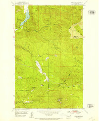
1952 Map of Deep Lake
USGS Topo · Published 1953About this map
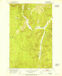
Deep Lake sits at the northwestern edge of this landscape where the high peaks of the Colville National Forest and Kaniksu National Forest meet. The 1952 field check documents an active period of resource extraction across the Stevens and Pend Oreille county line, evidenced by a cluster of named workings including the Bechtol Mine, Thompson Iron Mine, and Tyee Mine. The industrial footprint is balanced by a network of seasonal or logging outposts such as Smackout Camp and Speller Camp, connected by a complex system of jeep trails that navigate the steep drainages of Republican Creek and Smackout Creek. Local family names and small-scale clearings like the Divine Place, Peterson Clearing, and Pfaff Clearing suggest a pattern of remote habitation and early 20th-century homesteading within the broader forested valleys of Smackout Valley and Paradise Valley.
Find a feature on this map
38 named features on this map. Tap any name to fly to it.
Don’t see what you’re looking for? This feature index may not catch every label — zoom into the map to look around manually.
Map Details
Editions of this 1952 Deep Lake Map
4 editions found
Other maps of this area

1929 · Colville
USGS Topo · 1:125,000

1933 · Colville
USGS Topo · 1:125,000

1934 · Metaline
USGS Topo · 1:125,000

1942 · Metaline
USGS Topo · 1:125,000
1952 · Spirit
USGS Topo · 1:24,000
1952 · Leadpoint
USGS Topo · 1:24,000
1952 · Boundary
USGS Topo · 1:24,000

1952 · Aladdin
USGS Topo · 1:24,000

1958 · Sandpoint
USGS Topo · 1:250,000

1963 · Sandpoint
USGS Topo · 1:250,000