
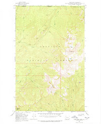
1967 Map of Gypsy Peak
USGS Topo · Published 1971About this map
Colville National Forest dominates this northern Washington landscape, where the international boundary between the United States and Canada is marked by high-altitude features like Boundary Mtn. The 1960s terrain is characterized by mineral exploration and fire management infrastructure, notably at the Lead Hill Mine and several prospects near the headwaters of Slate Creek. Transportation through these high ridges relied heavily on primitive routes like the Pack Trail and Jeep Trail, connecting isolated points such as the Lookout Tower on Sullivan Mtn to the surrounding drainage basins. Small water bodies like Gypsy Lakes and Watch Lake are tucked beneath the shadow of Gypsy Peak, reflecting a high-country wilderness before significant modern development altered the remote character of Pend Oreille County.
Find a feature on this map
36 named features on this map. Tap any name to fly to it.
Don’t see what you’re looking for? This feature index may not catch every label — zoom into the map to look around manually.
Map Details
Editions of this 1967 Gypsy Peak Map
3 editions found
Other maps of this area

1934 · Metaline
USGS Topo · 1:125,000

1942 · Metaline
USGS Topo · 1:125,000

1958 · Sandpoint
USGS Topo · 1:250,000

1963 · Sandpoint
USGS Topo · 1:250,000

1967 · Boundary Dam
USGS Topo · 1:24,000

1967 · Salmo Mtn.
USGS Topo · 1:24,000

1967 · Metaline Falls
USGS Topo · 1:24,000

1967 · Helmer Mtn
USGS Topo · 1:24,000

1967 · Pass Creek
USGS Topo · 1:24,000
1984 · Colville
USGS Topo · 1:100,000