
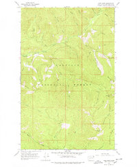
1967 Map of Pass Creek
USGS Topo · Published 1971About this map
Colville National Forest and Kaniksu National Forest converge in this high-altitude landscape of the late 1960s. The area is defined by a complex network of drainages including Sullivan Creek and its southern fork, which are fed by numerous smaller runs like Rainy Creek and Kinyon Creek. Human activity is concentrated along the creek bottoms and ridgelines, evidenced by established recreation sites such as Sullivan Creek Campground No 2 and Sullivan Creek Campground No 3.
Find a feature on this map
43 named features on this map. Tap any name to fly to it.
Don’t see what you’re looking for? This feature index may not catch every label — zoom into the map to look around manually.
Map Details
Editions of this 1967 Pass Creek Map
3 editions found
Other maps of this area

1934 · Metaline
USGS Topo · 1:125,000

1942 · Metaline
USGS Topo · 1:125,000

1958 · Sandpoint
USGS Topo · 1:250,000

1963 · Sandpoint
USGS Topo · 1:250,000

1967 · Gypsy Peak
USGS Topo · 1:24,000

1967 · Scotchman Lake
USGS Topo · 1:24,000

1967 · Boundary Dam
USGS Topo · 1:24,000

1967 · Salmo Mtn.
USGS Topo · 1:24,000

1967 · Metaline Falls
USGS Topo · 1:24,000

1967 · Monumental Mtn.
USGS Topo · 1:24,000