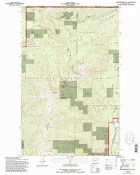
1992 Map of Abercrombie Mtn
USGS Topo · Published 1997About this map
Colville National Forest dominates the high-altitude terrain along the international border in this early 1990s survey. The landscape is defined by the massive profiles of Abercrombie Mtn and Hooknose Mtn, separated by the distinct Hooknose Ridge. This area shows a legacy of resource extraction, with multiple mines indicated near Jubilee Creek in the north and the Gold Hill Mine near the southern boundary, complete with a Gravel Pit and Tailings piles. In the lower elevations, the north end of Sullivan Lake provides a significant water feature, while a complex drainage network including Flume Creek and Russian Creek carves through the timbered slopes. The map captures a moment when industrial activity like mining and logging infrastructure intersected with the wilder stretches of Russian Ridge and Beaver Mtn.
Find a feature on this map
33 named features on this map. Tap any name to fly to it.
Don’t see what you’re looking for? This feature index may not catch every label — zoom into the map to look around manually.
Map Details
Editions of this 1992 Abercrombie Mtn Map
This is the sole edition of this map. No revisions or reprints were ever made.
Other maps of this area

1929 · Colville
USGS Topo · 1:125,000

1933 · Colville
USGS Topo · 1:125,000

1934 · Metaline
USGS Topo · 1:125,000

1942 · Metaline
USGS Topo · 1:125,000

1952 · Deep Lake
USGS Topo · 1:24,000

1952 · Leadpoint
USGS Topo · 1:24,000

1958 · Sandpoint
USGS Topo · 1:250,000

1963 · Sandpoint
USGS Topo · 1:250,000

1967 · Boundary Dam
USGS Topo · 1:24,000

1967 · Metaline
USGS Topo · 1:24,000