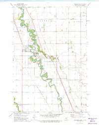
1973 Map of Abercrombie
USGS Topo · Published 1975About this map
The Red River meanders along the border of North Dakota and Minnesota, defining the landscape where Abercrombie and McCauleyville face each other across the winding water. This 1970s survey captures a transition point in the Red River Valley, where the extensive loopings of the river contrast with the rigid grid of the surrounding townships. History-minded researchers will find the Fort Abercrombie State Park prominently situated along the riverbank, marking a site of early frontier military importance. Settlement patterns here are dictated by the river and the competing rail lines of the Chicago Milwaukee St Paul and Pacific and the Burlington Northern. Local landmarks such as St Johns Ch and the St Thomas Cem near Kent provide specific touchpoints for genealogists tracing family roots in Richland and Wilkin Counties.
Find a feature on this map
25 named features on this map. Tap any name to fly to it.
Don’t see what you’re looking for? This feature index may not catch every label — zoom into the map to look around manually.
Map Details
Editions of this 1973 Abercrombie Map
This is the sole edition of this map. No revisions or reprints were ever made.
Other maps of this area

1895 · Fargo
USGS Topo · 1:125,000

1897 · Fargo
USGS Topo · 1:125,000

1904 · Wahpeton
USGS Topo · 1:125,000

1953 · Fargo
USGS Topo · 1:250,000

1956 · Fargo
USGS Topo · 1:250,000

1959 · Christine
USGS Topo · 1:24,000

1960 · Galchutt
USGS Topo · 1:24,000

1960 · Mooreton East
USGS Topo · 1:24,000

1964 · Dwight
USGS Topo · 1:24,000

1964 · Wahpeton
USGS Topo · 1:24,000