
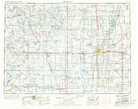
1954 Map of Aberdeen
USGS Topo · Published 1964About this map
Aberdeen serves as the regional hub for the northeastern South Dakota plains, situated amidst a landscape of numerous lakes and small prairie potholes. This mid-century survey reveals a highly developed rail network that supported the local agricultural economy, including the Chicago Milwaukee St Paul and Pacific Railroad and the Chicago and North Western Railway crossing the county. To the east, the Sand Lake National Wildlife Refuge and Dakota Lake Wildlife Refuge follow the course of the James River, highlighting early conservation efforts in the Central Flyway.
Find a feature on this map
140 named features on this map. Tap any name to fly to it.
Don’t see what you’re looking for? This feature index may not catch every label — zoom into the map to look around manually.
Map Details
Editions of this 1954 Aberdeen Map
2 editions found
Other maps of this area

1894 · Conde
USGS Topo · 1:62,500

1894 · Monango
USGS Topo · 1:62,500

1894 · Ellendale
USGS Topo · 1:62,500

1894 · Hecla
USGS Topo · 1:62,500

1894 · Columbia
USGS Topo · 1:62,500

1894 · Savo
USGS Topo · 1:62,500

1894 · Fullerton
USGS Topo · 1:62,500

1894 · Oakes
USGS Topo · 1:62,500

1895 · Byron
USGS Topo · 1:125,000

1895 · Lamoure
USGS Topo · 1:125,000