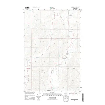
2014 Map of Aberdeen Gardens
USGS Topo · Published 2014About this map
The confluence of timber-rich river valleys and coastal development defines this corner of Grays Harbor County in the early 21st century. Aberdeen and Hoquiam anchor the southern margin, where the residential grids give way to the winding paths of the Wishkah River and the East Fork Hoquiam River. Small settlements like Aberdeen Gardens and Nisson are linked by rural corridors such as E Hoquiam Rd and Wishkah Rd, showing a landscape where agriculture and light aviation, represented by the Wishkah River Ranch Airport, occupy the level ground between steep timbered ridges. The intricate drainage network, including Berryman Cr and Wyman Cr, illustrates the hydrological complexity that has long shaped the local topography and land use patterns north of the harbor cities.
Find a feature on this map
38 named features on this map. Tap any name to fly to it.
Don’t see what you’re looking for? This feature index may not catch every label — zoom into the map to look around manually.
Map Details
Editions of this 2014 Aberdeen Gardens Map
This is the sole edition of this map. No revisions or reprints were ever made.
Other maps of this area

1940 · Montesano
USGS Topo · 1:62,500

1941 · Mobray
USGS Topo · 1:62,500

1943 · Humptulips
USGS Topo · 1:62,500

1943 · Mobray
USGS Topo · 1:62,500

1953 · Hoquiam
USGS Topo · 1:250,000

1955 · Montesano
USGS Topo · 1:62,500

1955 · Wynoochee Valley
USGS Topo · 1:62,500

1955 · Humptulips
USGS Topo · 1:62,500

1957 · Hoquiam
USGS Topo · 1:250,000
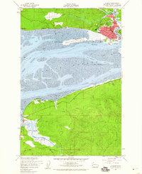
1957 · Hoquiam
USGS Topo · 1:24,000