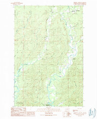
1990 Map of Aberdeen Gardens
USGS Topo · Published 1990About this map
The City of Hoquiam Watershed and the surrounding river valleys of Grays Harbor County define this landscape in the early 1990s. The map illustrates a region structured by its water systems, where the Wishkah River and Hoquiam River wind through the timberlands north of the coast. Small settlements and localized landmarks such as Nisson and the Aberdeen Gardens community are situated along these waterways, showing the residential footprint during this era.
Find a feature on this map
30 named features on this map. Tap any name to fly to it.
Don’t see what you’re looking for? This feature index may not catch every label — zoom into the map to look around manually.
Map Details
Editions of this 1990 Aberdeen Gardens Map
This is the sole edition of this map. No revisions or reprints were ever made.
Other maps of this area

1940 · Montesano
USGS Topo · 1:62,500

1941 · Mobray
USGS Topo · 1:62,500

1943 · Humptulips
USGS Topo · 1:62,500

1943 · Mobray
USGS Topo · 1:62,500

1953 · Hoquiam
USGS Topo · 1:250,000

1955 · Montesano
USGS Topo · 1:62,500

1955 · Wynoochee Valley
USGS Topo · 1:62,500

1955 · Humptulips
USGS Topo · 1:62,500

1957 · Hoquiam
USGS Topo · 1:250,000
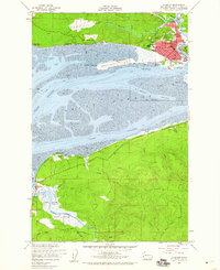
1957 · Hoquiam
USGS Topo · 1:24,000