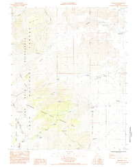
1985 Map of Aberdeen
USGS Topo · Published 1985About this map
The settlement of Aberdeen sits at the foot of the Eastern Sierra, where water management infrastructure meets the steep eastern slopes of the John Muir Wilderness. This mid-1980s landscape is defined by the sharp transition from the desert valley floor to high peaks like Colosseum Mtn. A network of hydraulic and recreational features supports the region, including the Division Creek Powerhouse and several dispersed camping sites such as the Sawmill Creek Campground.
Find a feature on this map
34 named features on this map. Tap any name to fly to it.
Don’t see what you’re looking for? This feature index may not catch every label — zoom into the map to look around manually.
Map Details
Editions of this 1985 Aberdeen Map
2 editions found
Other maps of this area

1907 · Mt. Whitney
USGS Topo · 1:125,000

1913 · Bishop
USGS Topo · 1:125,000

1919 · Mt. Whitney
USGS Topo · 1:125,000

1937 · Mt. Whitney
USGS Topo · 1:125,000

1947 · Mariposa
USGS Topo · 1:250,000

1948 · Fresno
USGS Topo · 1:250,000

1948 · Mariposa
USGS Topo · 1:250,000

1950 · Big Pine
USGS Topo · 1:62,500

1951 · Waucoba Mtn.
USGS Topo · 1:62,500

1951 · Independence
USGS Topo · 1:62,500