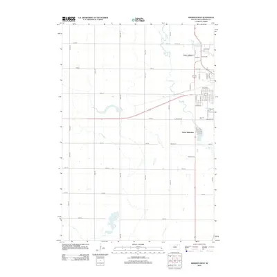
2012 Map of Aberdeen West
USGS Topo · Published 2012About this map
Lords Lake dominates the southern reaches of this landscape west of Aberdeen, where the South Dakota prairie begins its transition from rural section lines to suburban expansion. The western edge of the city is clearly visible through developments such as Harlin Addition and Derian Subdivision, reflecting the residential growth of Brown County in the early 21st century. The course of Foot Creek winds through the northern sections, passing near Wylie Lake and the established grounds of Riverside Cem. This survey illustrates the precise grid of the Great Plains, where long thoroughfares like 379th Ave and 131st St intersect the landscape, marking the persistent structure of agricultural land even as newer residential streets begin to fill the northern and eastern margins of the quadrangle.
Find a feature on this map
48 named features on this map. Tap any name to fly to it.
Don’t see what you’re looking for? This feature index may not catch every label — zoom into the map to look around manually.
Map Details
Editions of this 2012 Aberdeen West Map
This is the sole edition of this map. No revisions or reprints were ever made.
Other maps of this area

1894 · Columbia
USGS Topo · 1:62,500

1895 · Aberdeen
USGS Topo · 1:125,000

1896 · Columbia
USGS Topo · 1:125,000

1899 · Ellendale
USGS Topo · 1:125,000

1899 · Northville
USGS Topo · 1:125,000

1952 · Ordway
USGS Topo · 1:24,000

1953 · Warner
USGS Topo · 1:24,000

1954 · Aberdeen
USGS Topo · 1:250,000

1956 · Aberdeen
USGS Topo · 1:250,000
1960 · Aberdeen East
USGS Topo · 1:24,000