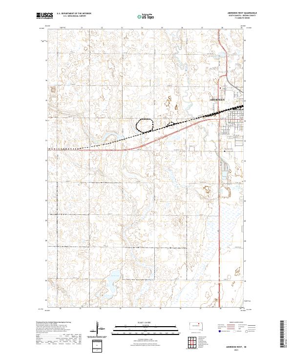
2021 Map of Aberdeen West
USGS Topo · Published 2021About this map
Aberdeen anchors the northeastern portion of this Brown County landscape, showing the city's westward expansion toward the meandering path of Foot Creek. The transition from urban streets like 24th Ave NW and 6th Ave SW to the systematic section-line road grid reveals the classic Midwestern agricultural organization of the Glacial Lake Dakota plain. In the northern reaches, Wylie Lake serves as a prominent water feature, while the southern terrain is marked by the irregular basin of Lords Lake. Local history is captured in landmarks such as Riverside Cem and the distinctive 9th Curve, reflecting how the area's infrastructure adapted to the natural hydrology of the James River Valley. The map documents a contemporary view of the region's transport network, including the intersection of Davis Rd and Co Hwy 19 amidst a landscape dotted with numerous small wetlands and basins.
Find a feature on this map
53 named features on this map. Tap any name to fly to it.
Don’t see what you’re looking for? This feature index may not catch every label — zoom into the map to look around manually.
Map Details
Editions of this 2021 Aberdeen West Map
This is the sole edition of this map. No revisions or reprints were ever made.
Other maps of this area

1894 · Columbia
USGS Topo · 1:62,500

1895 · Aberdeen
USGS Topo · 1:125,000

1896 · Columbia
USGS Topo · 1:125,000

1899 · Ellendale
USGS Topo · 1:125,000

1899 · Northville
USGS Topo · 1:125,000

1952 · Ordway
USGS Topo · 1:24,000

1953 · Warner
USGS Topo · 1:24,000

1954 · Aberdeen
USGS Topo · 1:250,000

1956 · Aberdeen
USGS Topo · 1:250,000
1960 · Aberdeen East
USGS Topo · 1:24,000