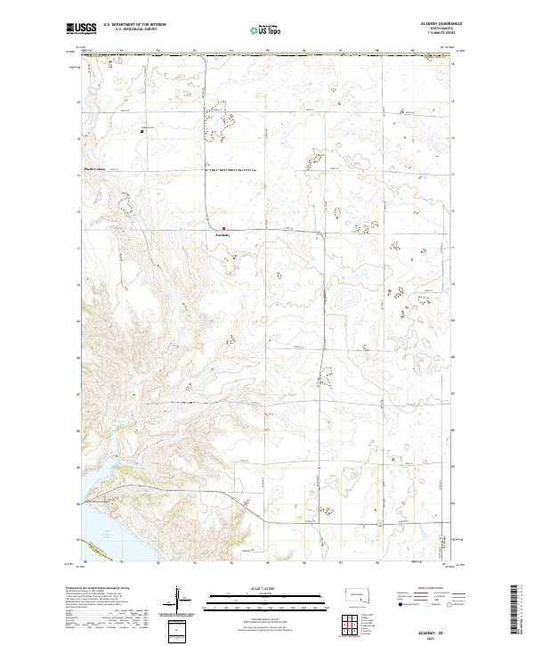
2021 Map of Academy
USGS Topo · Published 2021About this map
The Missouri River valley in South Dakota is dominated here by the expansive waters of Lake Francis Case, where the Platte-Winner Bridge crosses the water near the southern edge of Charles Mix County. The landscape transitions from the river bluffs to the high plains, marked by the small settlement of Academy and the communal layout of Platte Colony. Local history is anchored by the LaRoche Cem, which sits north of the colony near the winding course of Snake Cr. The road network follows a strict sectional grid, with numbered avenues and streets like 355th Ave and 270th St providing the structure for this agricultural region. This survey captures a rural landscape where traditional settlements and modern infrastructure meet at the river's edge.
Find a feature on this map
32 named features on this map. Tap any name to fly to it.
Don’t see what you’re looking for? This feature index may not catch every label — zoom into the map to look around manually.
Map Details
Editions of this 2021 Academy Map
This is the sole edition of this map. No revisions or reprints were ever made.
Other maps of this area

1955 · Mitchell
USGS Topo · 1:250,000

1959 · Mitchell
USGS Topo · 1:250,000

1971 · Lucas NW
USGS Topo · 1:24,000

1971 · Academy
USGS Topo · 1:24,000

1971 · Lucas
USGS Topo · 1:24,000

1971 · Lucas SE
USGS Topo · 1:24,000

1979 · Castalia
USGS Topo · 1:24,000

1979 · Eagle
USGS Topo · 1:24,000
1979 · Bijou Hills
USGS Topo · 1:24,000

1979 · Lake George
USGS Topo · 1:24,000
Featured Places
- Lake George Township, SD
- Eagle Township, SD
- Pleasant Grove Township, SD
- La Roche Township, SD
- Castalia Township, SD