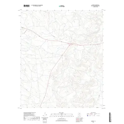
2019 Map of Acampo
USGS Topo · Published 2019About this map
Bluff Cr and Chimney Cr carve through this portion of Shackelford County, defining a landscape dominated by ranching and resource management. The geography is marked by the drainage basins of the N Fork Salt Prong Hubbard Cr and the winding Flat Rock Cr to the southeast. Transportation throughout the area is facilitated by a network of rural routes including Chimney Creek Ranch Rd and the specialized Game Patrol Rd, reflecting the land's utility for private estates and conservation efforts. These roads provide access to the interior terrain between Albany Lake Rd and Co Rd 220, where the drainage patterns of the Texas Rolling Plains shape the local environment.
Find a feature on this map
8 named features on this map. Tap any name to fly to it.
Don’t see what you’re looking for? This feature index may not catch every label — zoom into the map to look around manually.
Map Details
Editions of this 2019 Acampo Map
This is the sole edition of this map. No revisions or reprints were ever made.
Other maps of this area

1891 · Anson
USGS Topo · 1:125,000

1892 · Albany
USGS Topo · 1:125,000

1893 · Albany
USGS Topo · 1:125,000

1893 · Anson
USGS Topo · 1:125,000

1954 · Abilene
USGS Topo · 1:250,000

1957 · Nugent
USGS Topo · 1:62,500

1958 · Abilene
USGS Topo · 1:250,000

1965 · Acampo
USGS Topo · 1:24,000

1965 · Lueders East
USGS Topo · 1:24,000

1965 · Albany
USGS Topo · 1:24,000