
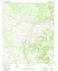
1965 Map of Acampo
USGS Topo · Published 1967About this map
The Missouri Kansas Texas railroad cuts through this Shackelford County landscape, serving small trackside settlements like Acampo and Katy. In the mid-1960s, this area was defined by its extractive economy, with a large Oil Field and numerous scattered Oil Wells, Drill Hole sites, and a Quarry indicating active resource development. The terrain is marked by the winding courses of North Fork Salt Prong Hubbard Creek and its tributaries, including Bluff Creek and Chimney Creek. Near the southern edge, localized industry is further evidenced by a Gravel Pit and Borrow Pits, while McCarty Lake provides a rare contained water source amidst the rolling plains. Small hubs like Stewart and Aggie represent the sparse but organized settlement patterns of rural Texas during this era of post-war ranching and petroleum production.
Find a feature on this map
22 named features on this map. Tap any name to fly to it.
Don’t see what you’re looking for? This feature index may not catch every label — zoom into the map to look around manually.
Map Details
Editions of this 1965 Acampo Map
2 editions found
Other maps of this area

1891 · Anson
USGS Topo · 1:125,000

1892 · Albany
USGS Topo · 1:125,000

1893 · Albany
USGS Topo · 1:125,000

1893 · Anson
USGS Topo · 1:125,000

1954 · Abilene
USGS Topo · 1:250,000

1957 · Nugent
USGS Topo · 1:62,500

1958 · Abilene
USGS Topo · 1:250,000

1965 · Lueders East
USGS Topo · 1:24,000

1965 · Albany
USGS Topo · 1:24,000
1965 · Collins Creek SW
USGS Topo · 1:24,000