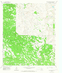
1965 Map of Collins Creek SW
USGS Topo · Published 1967About this map
Oil fields and scattered drill holes define the economic landscape of Shackelford County in the mid-1960s, showing a region where petroleum extraction and ranching coexist. The terrain is marked by a complex network of seasonal drainage, with Fish Creek and Swager Creek cutting through the center, while Bluff Creek flows across the southern portion. This 1965 survey documents the sparse settlement patterns of the Texas ranchlands, identifying small localities like Monroe and Cook alongside infrastructure such as a Radio Tower and a Quarry. The widespread presence of oil wells and private fence lines indicates a highly partitioned landscape of mineral rights and livestock production, typical of the Rolling Plains during this era. Traceable landmarks like Cook Creek provide useful orientation for family researchers and local historians interested in the mid-century development of these rural Texas outposts.
Find a feature on this map
13 named features on this map. Tap any name to fly to it.
Don’t see what you’re looking for? This feature index may not catch every label — zoom into the map to look around manually.
Map Details
Editions of this 1965 Collins Creek SW Map
2 editions found
Other maps of this area

1891 · Anson
USGS Topo · 1:125,000

1892 · Albany
USGS Topo · 1:125,000

1893 · Albany
USGS Topo · 1:125,000

1893 · Anson
USGS Topo · 1:125,000

1954 · Abilene
USGS Topo · 1:250,000

1957 · Nugent
USGS Topo · 1:62,500

1958 · Abilene
USGS Topo · 1:250,000

1965 · Acampo
USGS Topo · 1:24,000

1965 · Lueders NE
USGS Topo · 1:24,000

1965 · Collins Creek
USGS Topo · 1:24,000