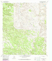
1965 Map of Collins Creek SW
USGS Topo · Published 1987About this map
Oil Field operations dominate this Shackelford County landscape, where numerous wells and drill holes are scattered across a complex network of ridges and drainages. The topography is defined by the winding paths of Fish Creek, Swayer Creek, Cook Creek, and Bluff Creek, which carve through the terrain. In addition to the extractive industry, the map identifies small landmarks such as a Radio Tower and a Landing Strip, indicating the specialized infrastructure required for managing these remote operations in the mid-1960s. Local geographic markers like Monroe and Cook provide specific points of reference within this resource-rich pocket of the Texas plains. A Quarry near the southeastern corner further emphasizes the area's industrial character during this period of development and revision.
Find a feature on this map
13 named features on this map. Tap any name to fly to it.
Don’t see what you’re looking for? This feature index may not catch every label — zoom into the map to look around manually.
Map Details
Editions of this 1965 Collins Creek SW Map
2 editions found
Other maps of this area

1891 · Anson
USGS Topo · 1:125,000

1892 · Albany
USGS Topo · 1:125,000

1893 · Albany
USGS Topo · 1:125,000

1893 · Anson
USGS Topo · 1:125,000

1954 · Abilene
USGS Topo · 1:250,000

1957 · Nugent
USGS Topo · 1:62,500

1958 · Abilene
USGS Topo · 1:250,000

1965 · Acampo
USGS Topo · 1:24,000

1965 · Lueders NE
USGS Topo · 1:24,000

1965 · Collins Creek
USGS Topo · 1:24,000