
1965 Map of Lueders East
USGS Topo · Published 1967About this map
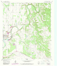
The Clear Fork Brazos River winds through the borderlands of Jones and Shackelford Counties, defining a landscape shaped by both natural hydrology and mid-century industry. The settlement of Lueders serves as a primary hub, accompanied by the nearby Lueders Encampment and the Lueders Cem. This area reveals a significant extractive economy, with extensive Oil Field operations and numerous quarries and gravel pits dotting the terrain.
Find a feature on this map
24 named features on this map. Tap any name to fly to it.
Don’t see what you’re looking for? This feature index may not catch every label — zoom into the map to look around manually.
Map Details
Editions of this 1965 Lueders East Map
2 editions found
Other maps of this area

1891 · Anson
USGS Topo · 1:125,000

1892 · Albany
USGS Topo · 1:125,000

1893 · Albany
USGS Topo · 1:125,000

1893 · Anson
USGS Topo · 1:125,000

1954 · Abilene
USGS Topo · 1:250,000

1957 · Nugent
USGS Topo · 1:62,500

1958 · Abilene
USGS Topo · 1:250,000

1965 · Acampo
USGS Topo · 1:24,000

1965 · Lueders NW
USGS Topo · 1:24,000

1965 · Lueders NE
USGS Topo · 1:24,000