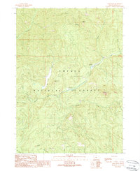
1989 Map of Acker Rock
USGS Topo · Published 1989About this map
The South Umpqua River carves through this portion of the Umpqua National Forest, defining a landscape of sharp elevation changes and critical water sources. Central to the area is the South Umpqua Falls and its adjacent South Umpqua Falls Campground, serving as a primary point of interest for those traversing the river corridor. High points like Acker Rock, Flagstone Peak, and Coyote Point provide distinct landmarks above the drainage basins of Buckeye Creek and Quartz Creek.
Find a feature on this map
29 named features on this map. Tap any name to fly to it.
Don’t see what you’re looking for? This feature index may not catch every label — zoom into the map to look around manually.
Map Details
Editions of this 1989 Acker Rock Map
This is the sole edition of this map. No revisions or reprints were ever made.
Other maps of this area

1891 · Ashland
USGS Topo · 1:250,000

1893 · Ashland
USGS Topo · 1:250,000

1897 · Ashland
USGS Topo · 1:250,000

1944 · Tiller
USGS Topo · 1:62,500

1944 · Abbott Butte
USGS Topo · 1:62,500

1947 · Abbott Butte
USGS Topo · 1:62,500

1955 · Quartz Mtn
USGS Topo · 1:62,500

1955 · Red Butte
USGS Topo · 1:62,500

1955 · Medford
USGS Topo · 1:250,000

1957 · Medford
USGS Topo · 1:250,000