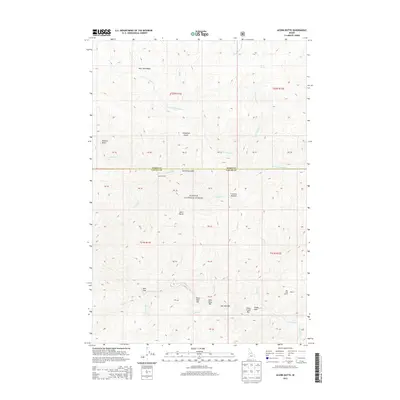
2013 Map of Acorn Butte
USGS Topo · Published 2013About this map
Payette National Forest dominates this interior landscape of central Idaho, where the high-altitude terrain is defined by deep drainages and named bars along the watercourses. The intersection of Idaho and Valley Counties runs through the center of the sheet, marking a remote boundary between these two expansive regions. Along the southern reaches, Big Creek is punctuated by a series of uniquely named riverside flats including Hard Boil Bar, Over Easy Bar, and Soft Boil Bar. To the north, the elevation rises toward Acorn Butte and the West Fork Basin. Small markers of human presence, such as Jensen Cabin near Crooked Creek and the landing strip at Mile Hi, indicate the limited but specific points of access in this wilderness area, which also features the distinct Coxey Hole and Crescent Meadow.
Find a feature on this map
35 named features on this map. Tap any name to fly to it.
Don’t see what you’re looking for? This feature index may not catch every label — zoom into the map to look around manually.
Map Details
Editions of this 2013 Acorn Butte Map
This is the sole edition of this map. No revisions or reprints were ever made.
Other maps of this area

1956 · Elk City
USGS Topo · 1:250,000

1960 · Elk City
USGS Topo · 1:250,000

1962 · Mormon Mtn
USGS Topo · 1:24,000

1962 · Vinegar Hill
USGS Topo · 1:24,000

1973 · Center Mtn
USGS Topo · 1:24,000

1973 · Acorn Butte
USGS Topo · 1:24,000

1973 · Bismark Mtn
USGS Topo · 1:24,000
1973 · Monument
USGS Topo · 1:24,000

1978 · Wapiti Creek
USGS Topo · 1:24,000
1978 · Lodgepole Creek
USGS Topo · 1:24,000